Okla. Sees Chance Of Severe Storms Friday Bringing Threat Of Hail, Damaging Winds
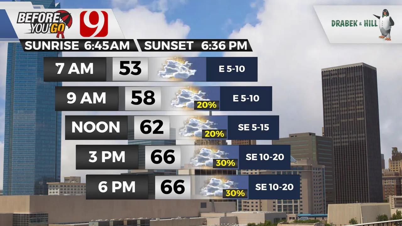
A warm front lifts north Friday! That means temperatures will be back in the 60s and 70s.Friday, March 12th 2021, 6:57 am
A warm front lifts north Friday! That means temperatures will be back in the 60s and 70s.
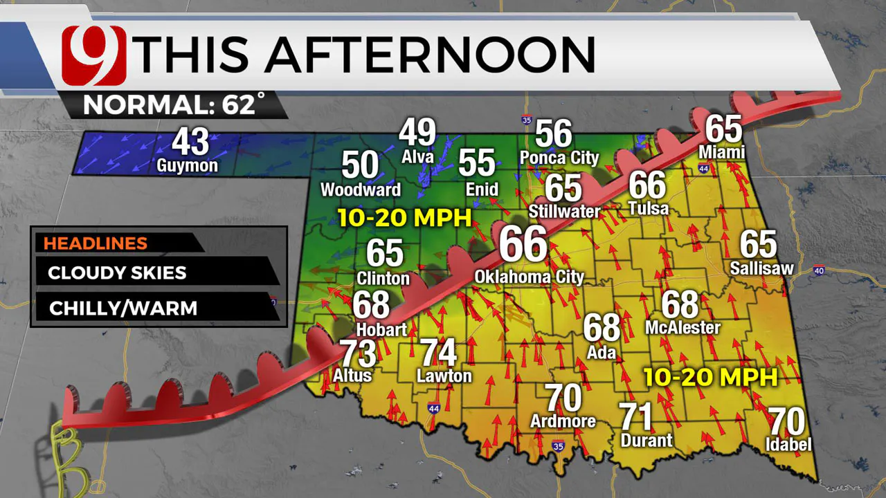
Northwest Oklahoma will still see chilly temperatures.
We will have popup thunderstorm chances into the afternoon.
This evening we will shift our attention to the Texas panhandle. Isolated thunderstorms are expected to fire on the dryline. Those storms will move to the northeast through the evening.
The question is, how far into the state will they make it before they lose their intensity? Right now it looks like they will be severe crossing into southwest Oklahoma OK. Ingredients are coming together for supercells in this area. That means these storms will be spinning.
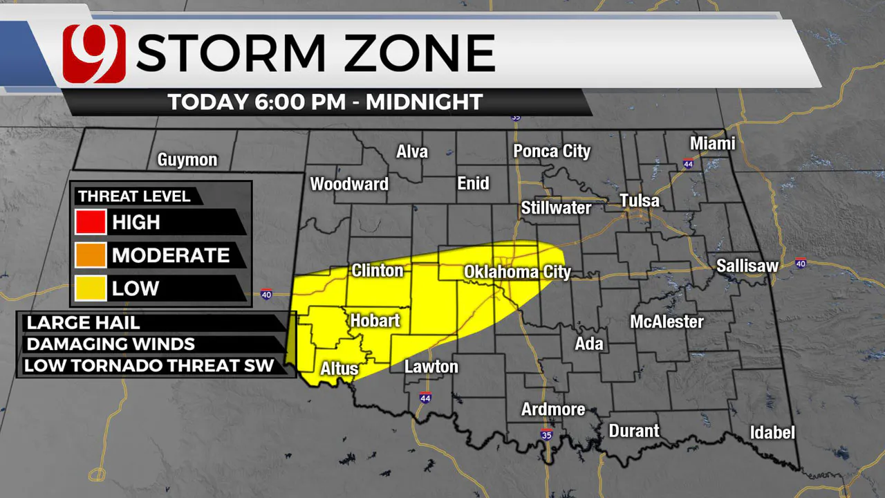
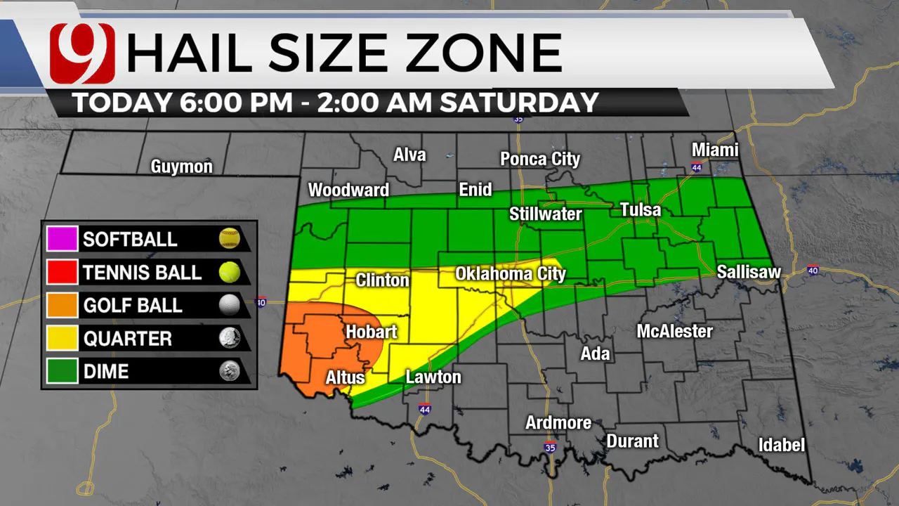
The main threats will be hail and damaging winds. Hail up to the size of golf balls and winds to 65 mph.
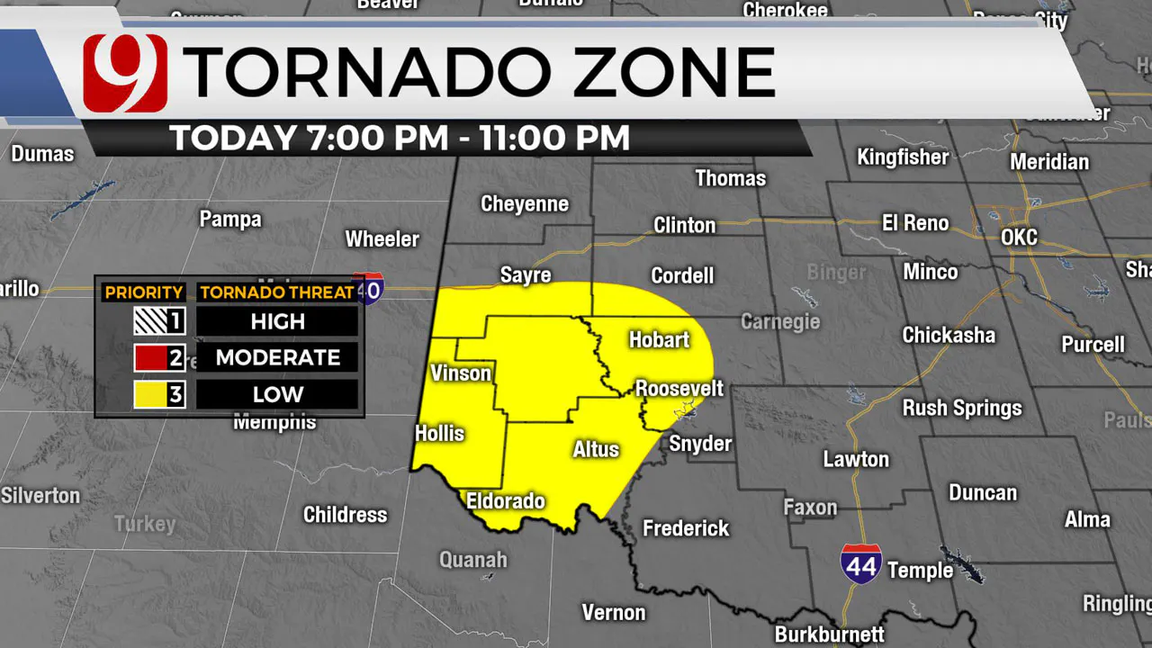
The tornado threat in the southwest is low Friday from 7 p.m. to 11 p.m. as these storms ride the warm front into Oklahoma City they will continue to weaken some.
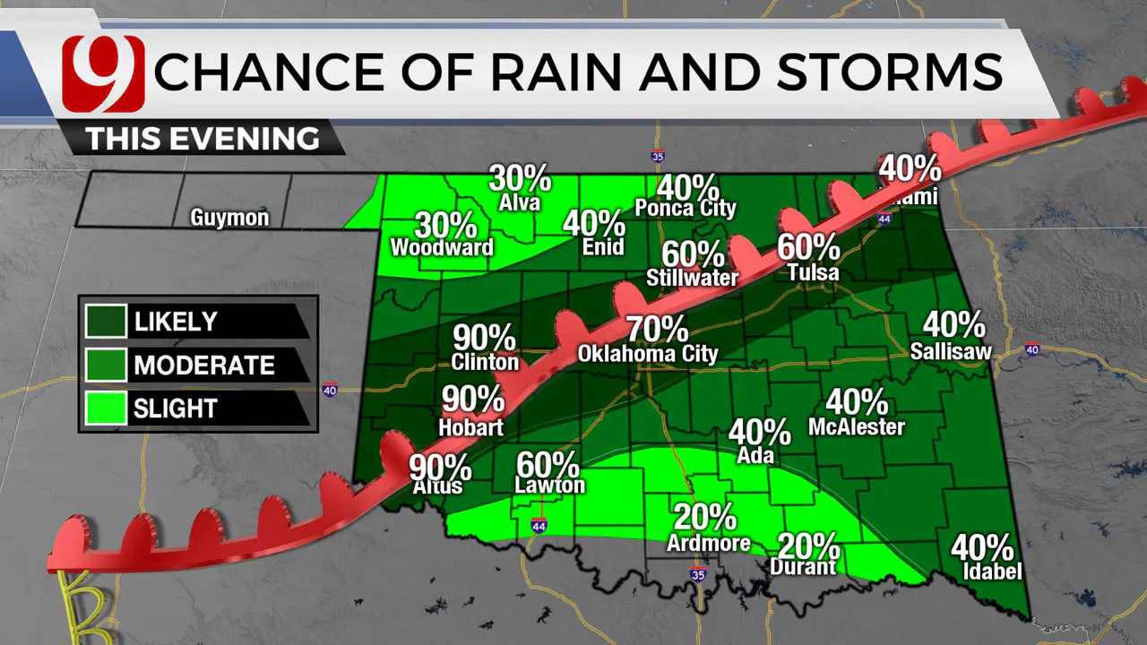
Additional storms are likely along and north of the front Friday evening and night.
In OKC the main threats are hail and wind.
Our trackers will be on these storms, and we will bring you updates!
More Like This
March 25th, 2024
March 1st, 2024
February 2nd, 2024
Top Headlines
April 25th, 2024
April 25th, 2024
April 25th, 2024


