

Tornado Warnings Issued In Southern Oklahoma As Severe Storms Travel Across State
One more round of thunderstorms is expected Wednesday afternoon as the main storm system moves across the state.Wednesday, April 22nd 2020, 8:54 am


One more round of thunderstorms is expected Wednesday afternoon as the main storm system moves across the state.
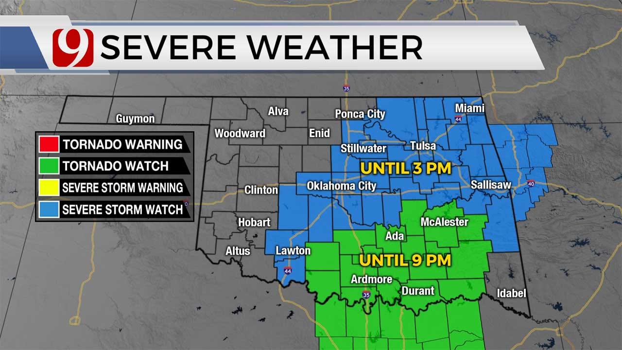
A tornado watch was issued until 9 p.m. for 17 counties including Carter, Garvin, Hughes, Jefferson, Love, Murray, Pontotoc and Stephens counties. Storms have developed and are moving east into the News 9 watch area.
At least three tornado warnings were issued late Wednesday afternoon in southern Oklahoma as storms made their way eastward.

The highest threat of severe weather will primarily be south of the Oklahoma City metro area which will be south of the front.

Hail sizes could reach up to tennis balls in southern Oklahoma. That's also where the highest tornado threat will setup.


Stormtrackers are out and we'll be watching!


Matt Mahler
<p>Meteorologist Matt Mahler forecasts the weather weekend mornings on News 9. Matt joined the News 9 family in December 2009.</p>

Get The Daily Update!
Be among the first to get breaking news, weather, and general news updates from News 9 delivered right to your inbox!
More Like This


June 3rd, 2025


June 2nd, 2025
Top Headlines

June 7th, 2025

June 7th, 2025

