Strong Storm Systems Approaching Oklahoma This Weekend
One of the strongest storm systems of the year is taking shape over the Pacific Northwest and will be approaching Oklahoma this weekend into early next week.Friday, May 17th 2013, 4:19 pm
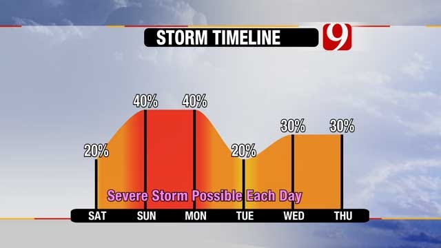
One of the strongest storm systems of the year is taking shape over the Pacific Northwest and will be approaching Oklahoma this weekend into early next week. All modes of severe weather will be possible with thunderstorms that do develop including large hail, damaging winds, and tornadoes.
Saturday: The best chance for storm development will be in western Oklahoma during the peak heating hours. Any storms that do get established will be capable of large hail, damaging winds, and isolated tornadoes.
Sunday: A dryline will move into central Oklahoma, and should lead to storm development along and east of I-35. Again conditions will be favorable for supercell development during the peak heating hours. Storms will be capable of large hail, damaging winds, and a higher probability of tornadoes.
Monday: Best chance for storms will be in central and northeastern OK. Timing and intensity for Monday will be highly dependent on Sunday's storms.
Make sure you have a way to get watches and warnings as you make your plans this weekend.
We are constantly analyzing the latest data, and will post timing and location updates as necessary.
Stay with News 9, we'll keep you advised.
More Like This
May 17th, 2013
March 22nd, 2024
March 14th, 2024
February 9th, 2024
Top Headlines
April 26th, 2024
April 26th, 2024
April 26th, 2024


