

Winter Storm Timeline: What to expect on Tuesday and Wednesday
Oklahoma is in for a wild ride of winter weather over the next 24 hours. A powerful system is moving through the state, bringing a messy mix of precipitation, including freezing rain, sleet, and snow.Tuesday, February 11th 2025, 11:55 am

Oklahoma is in for a wild ride of winter weather over the next 24 hours. A powerful system is moving through the state, bringing a messy mix of precipitation, including freezing rain, sleet, and snow. The exact type of wintry mix you’ll experience depends on the temperature layers in the atmosphere, and this system will throw nearly all types at us.
Winter Storm Incoming: Freezing rain, sleet, and snow expected across Oklahoma

 Winter Storm Timeline: What to expect on Tuesday and Wednesday


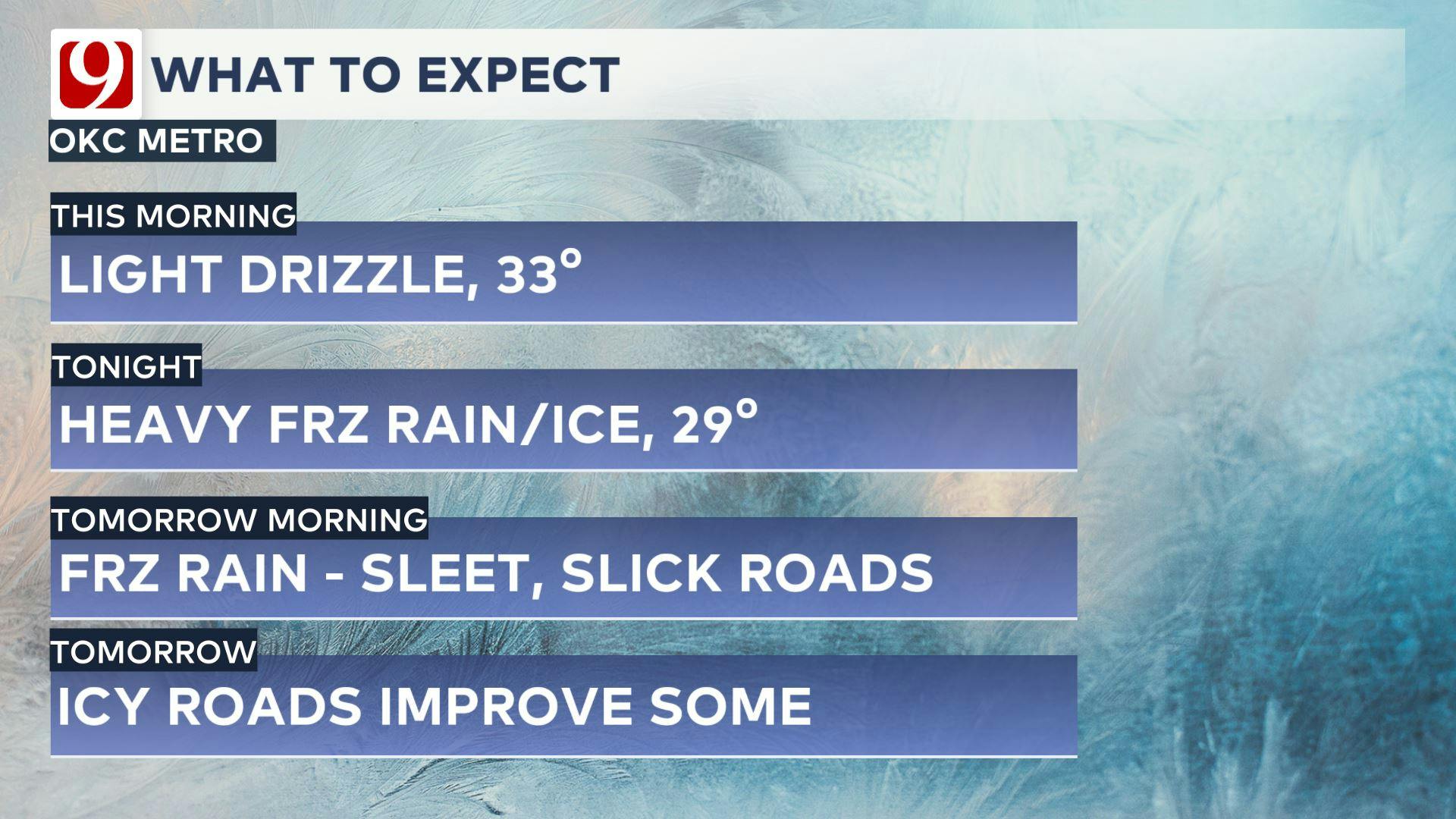
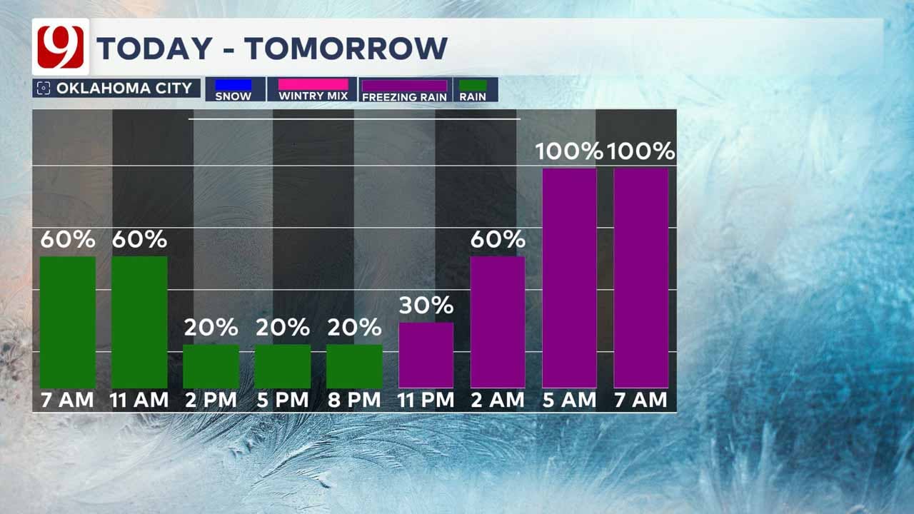
Here is a breakdown of what to expect:
Tuesday Afternoon & Evening
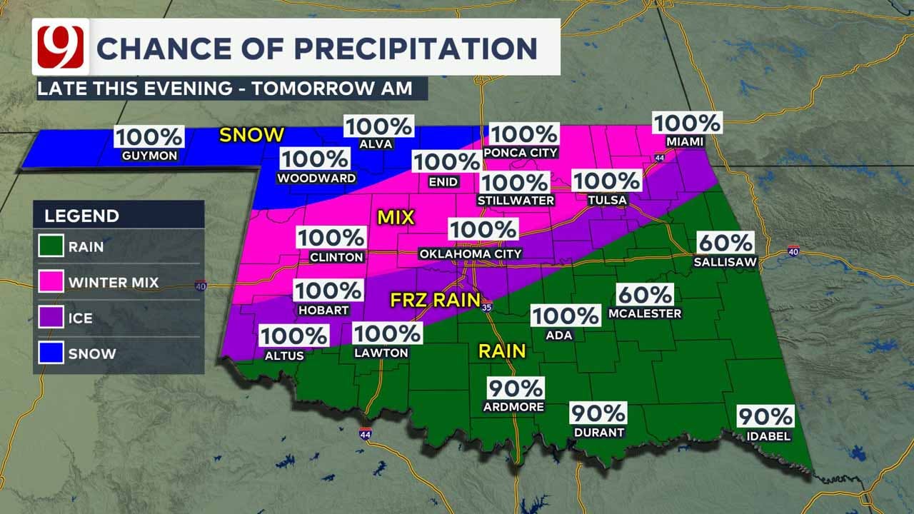
Noon- 6 PM: Cloudy skies dominate with light drizzle possible in central Oklahoma.
6 PM - 10 PM: Temperatures hover just above freezing, with isolated showers developing.
Overnight (Tuesday Night - Early Wednesday Morning)
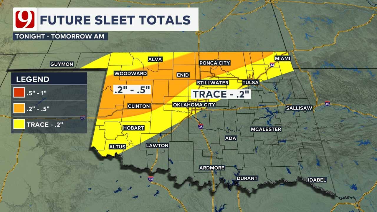
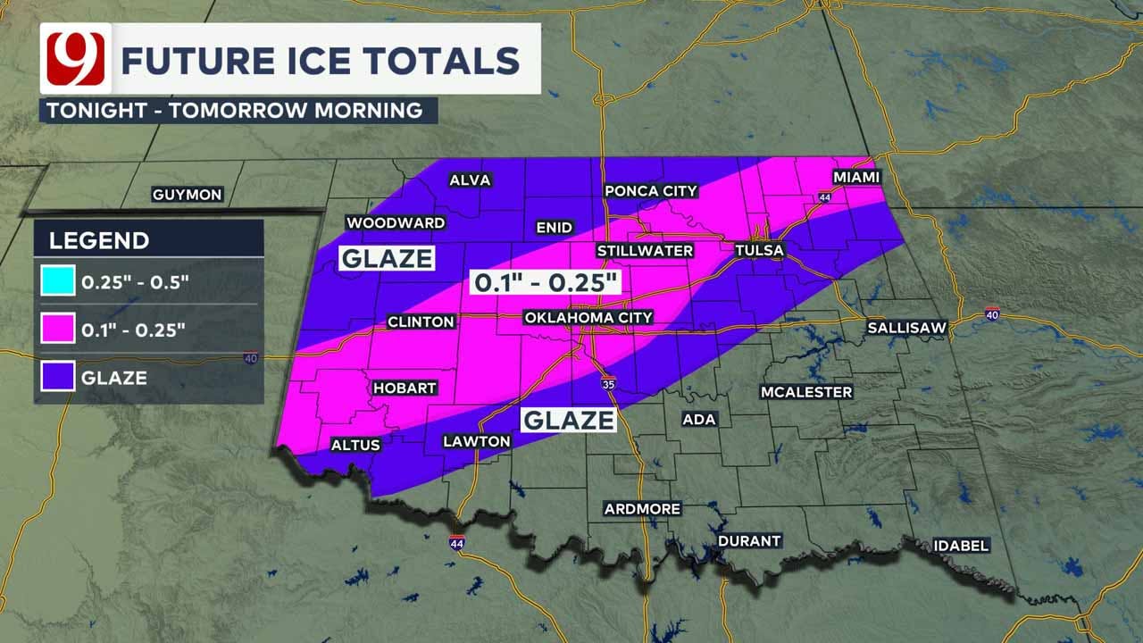
10 PM - Midnight: Freezing rain and sleet begin to develop in southwestern Oklahoma.
Midnight - 2 AM: Heavy precipitation moves into central Oklahoma, with freezing rain becoming the dominant type. Thunderstorms may enhance ice accumulation.
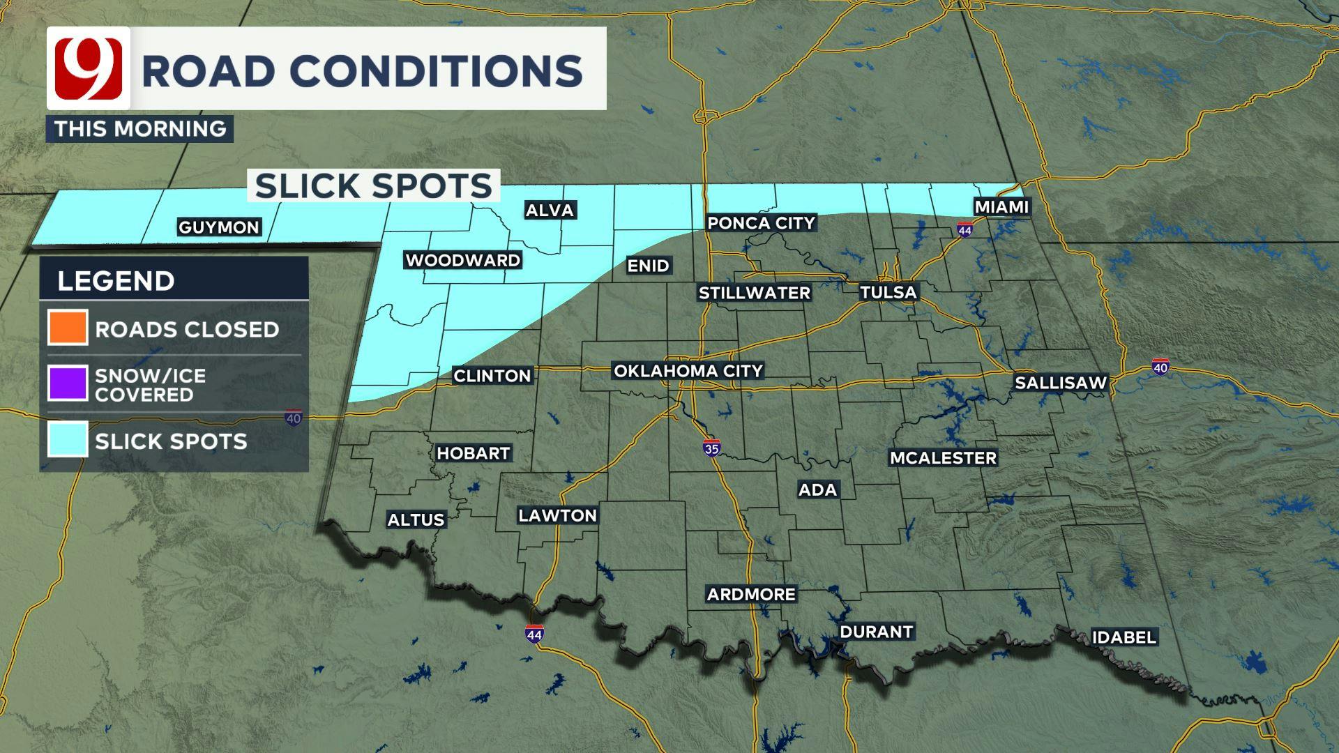
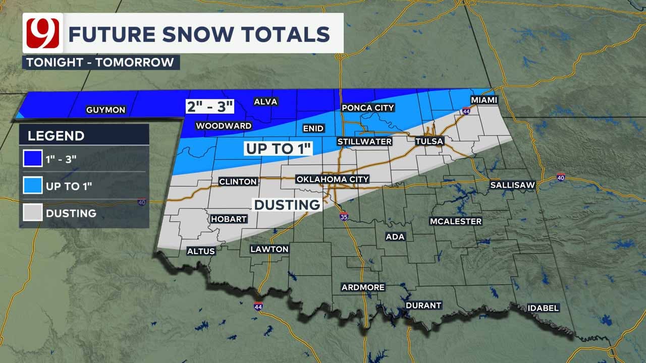
2 AM - 5 AM: Sleet mixes in, leading to quick pavement cooling and treacherous road conditions. Snow begins falling in northern Oklahoma.
Wednesday Morning
5 AM - 9 AM: Metro transitions from freezing rain to sleet, with some areas seeing light snow. Heavy sleet north of OKC leads to icy roads.
9 AM - 12 PM: Precipitation lightens up, but lingering icy conditions remain a concern. Snow continues in northern Oklahoma.
12 PM - 3 PM: The system exits the state, leaving behind icy roads and freezing temperatures.
Wednesday Afternoon - Thursday Morning
3 PM - 6 PM: Temperatures struggle to climb, staying below freezing statewide.
Overnight into Thursday: Lows drop into the low teens, bringing dangerous wind chills and the potential for pipe-bursting temperatures.

Anna Denison
Anna is the Lead Digital Producer at News 9 and has been creating and managing social media content and online articles for the newsroom since October of 2024.

Get The Daily Update!
Be among the first to get breaking news, weather, and general news updates from News 9 delivered right to your inbox!
More Like This

February 11th, 2025

June 22nd, 2025

June 22nd, 2025

June 22nd, 2025
Top Headlines

June 22nd, 2025

June 22nd, 2025

