Strong Winds, Possible Tornadoes Sweep Across Green Country With Severe Storms
A fast-moving storm system that swept across Green Country to the northeast on Sunday brought damaging winds and possible tornadoes in southeast Oklahoma.Monday, February 27th 2023, 12:57 am


TULSA, Okla. -
A fast-moving storm system that swept across Green Country to the northeast on Sunday brought damaging winds and possible tornadoes in southeast Oklahoma.
At one point Sunday evening, the National Weather Service said the storm was moving northeast at 105 mph. Another aspect of the storm that Chief Meteorologist Travis Meyer noted during coverage was the lack of cloud-to-ground lightning strikes, which made it difficult for trackers to confirm any tornadoes on the ground.
Reports of damage from these storms in Norman were prevalent by 10 p.m. as the Severe Thunderstorm Warnings and Tornado Warnings became active in Green Country.
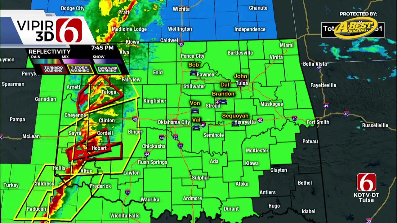
Many counties were under Tornado Warnings with the storm, including Kay, Noble, Lincoln, Creek, Okfuskee, Okmulgee, Muskogee, Rogers, Wagoner, Mayes, Ottawa and Sequoyah counties as late as 1 a.m. on Monday.
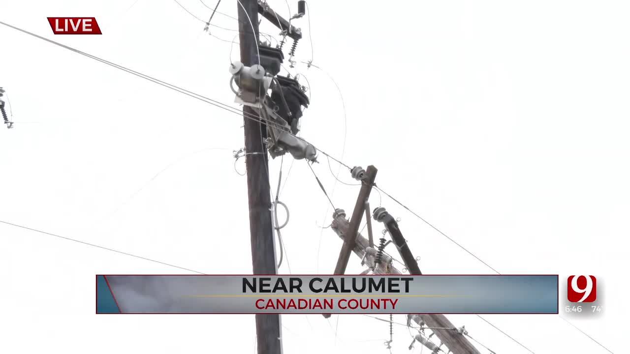
There were reports of power flashes and debris in the air in some counties with this storm, but no confirmed tornadoes touched down or caused damage in Green Country as of now.
---
Severe storms with damaging wind that spawned tornadoes in Western Oklahoma are moving across Green Country Sunday night at speeds of 105 mph, according to the National Weather Service.
Click Here To View The Latest Watches And Warnings Around Green Country
A possible-tornado has been seen on radar just southeast of Coweta as Tornado Warnings remain active until midnight.

The system, which is moving northeast at those high speeds, can bring penny-sized hail and considerable damage to trees, mobile homes, roofs and other buildings due to the wind speed.
Click Here to View The News On 6 WARN Radar for Real-time Weather Updates
The path of the storm as of 10:45 p.m. appears to be in the areas of Creek, Muskogee, Okfuskee, Okmulgee, Osage, Pawnee, Rogers, Tulsa and Wagoner counties.
TORNADO WARNINGS:
- Sequoyah County under Tornado Warning until 1:15 a.m.
SEVERE THUNDERSTORM WARNING:
- Adair, Cherokee, Delaware, Haskell, LeFlore, Ottawa, Sequoyah counties under Severe Thunderstorm Warning until 1:15 a.m.
TORNADO WATCH:
- Tulsa, Wagoner Adair, Cherokee, Craig, Creek, Delaware, Haskell, Hughes, Kay, Latimer, Lincoln, McIntosh, Mayes, Muskogee, Noble, Nowata, Okfuskee, Okmulgee, Osage, Ottawa, Pawnee, Payne, Pittsburg, Pushmataha, Rogers and Sequoyah and Washington counties are under a Tornado Watch until 1 a.m.
The storms moving in from the west have already produced brief tornadoes and extraordinary winds in excess of 70-80 mph, according to meteorologists at our sister station News 9.
---
A chilly and cloudy day is underway before a fast-moving line of storms sweeps across the state on Sunday evening, bringing strong winds, hail and the threat of tornados to parts of the state.
According to News On 6 Meteorologist Stephen Nehrenz, a powerful system will bring a significant severe weather risk, especially to areas around western and central Oklahoma on Sunday evening.
When Will Severe Weather Move Into Oklahoma?
Far western parts of the state could begin to see some effects of the storm system around 4 p.m. on Sunday afternoon, but areas across the state can expect to see some spotty showers throughout the day.
Between 6 p.m. and 10 p.m., the line of storms is expected to move through western Oklahoma and into the Tulsa area.
Around 10 p.m., the line of intense storms will march into Green Country, bringing the potential for some tornado spin-ups and some damaging winds.
The fast-moving line of storms is then expected to exit Green Country around 1 a.m.
What Are The Severe Weather Threats On Sunday?
Sunday's storms bring the threat of significantly damaging winds between 9 p.m. Sunday and 1 a.m. Monday. winds could reach as high as 70 MPH in some areas.
Parts of the state will also see the threat of tornadoes on Sunday. According to Meteorologist Stephen Nehrenz, there is the potential that a tornado could develop along the leading edge of the line of storms.

Get The Daily Update!
Be among the first to get breaking news, weather, and general news updates from News 9 delivered right to your inbox!
More Like This
February 27th, 2023

April 27th, 2024

Top Headlines


April 27th, 2024
April 27th, 2024
