

Heat Advisories Return
Heat advisories will return both Monday and Tuesday before the next cold front arrives with storm chances and some cooler weather.Monday, August 15th 2022, 6:58 am
TULSA, Okla. -
Heat advisories will return both Monday and Tuesday before the next cold front arrives with storm chances and some cooler weather.
Here are the details from News On 6 Meteorologist Alan Crone:

The ridge will be shunted southwest of the area over the next 36 hours as a series of upper-level troughs influence the northern plains and upper Midwest. Our next system arrives Tuesday with a surface low developing along a leading cold front that moves from Kansas into part of northeastern OK by afternoon and evening. Scattered storms will be possible ahead of the surface low and along the boundary Tuesday afternoon and evening. A few of these storms could be severe with damaging wind possibilities. Higher chances should be across far NE OK, SE KS, SW MO, and NW AR, but there will be some scattered activity along the boundary as it slides south Tuesday evening into pre-dawn Wednesday morning. This front will take precip chances out of the area early Wednesday, but drier and not-as-hot weather remains with Wednesday afternoon highs in the lower 80s. We’ll gradually warm Thursday to near 90 and back into the lower 90s Friday and Saturday before another system nears the state Sunday. While the exact evolution of the weekend pattern is not solid yet, it does appear we may be heading into a notable pattern change. The mid-level ridge of high pressure does not appear to make a big comeback next week, and the flow should remain active. This would mean at least two things of significance: Not as hot weather and the return of rain chances. I’ll have more about this potential for next week in tomorrow’s post.

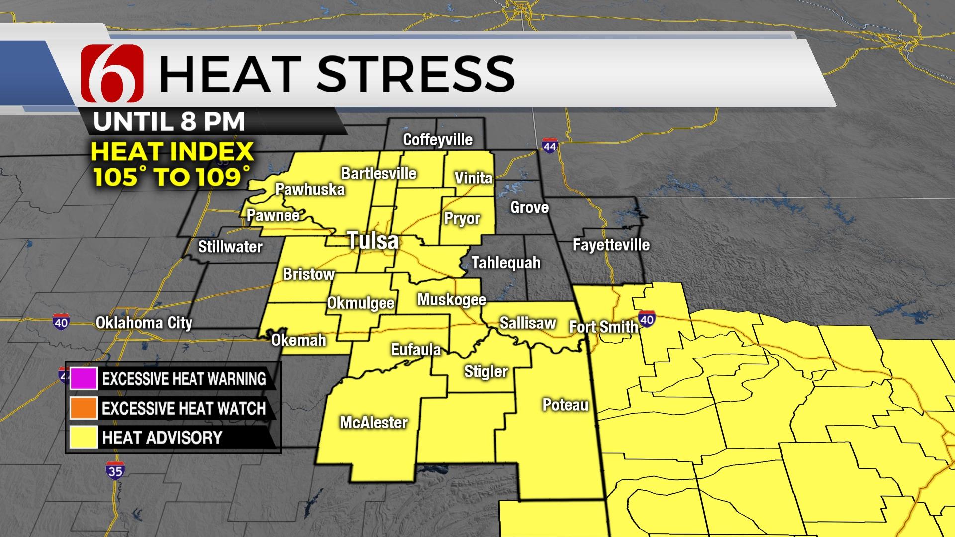
Heat and humidity will continue to be problematic both today and tomorrow ahead of the Tuesday afternoon front. Low level moisture will be increasing today, and this will pump heat index values into the lower end of advisory criteria. This means another heat advisory will be required today for a large part of the area. Humidity values may drop some tomorrow, but the southwest component to the wind may also allow a slightly higher temperature ahead of the front Tuesday afternoon. This could crank the temps to near 105, and advisories will also be required.

Thanks for reading the Monday morning weather discussion and blog.
Have a super great day!
Alan Crone
KOTV
If you’re into podcasts, check out my daily weather update. Search for NewsOn6 and ‘Weather Out The Door’ on most podcast providers, including Spotify, Stitcher and Tune-In, or Click Here to listen on Apple Podcasts.


Alan Crone
An integral part of the News On 6 Weather Team since 2006, Alan Crone keeps Oklahomans safe and informed about morning weather each weekday on Six in the Morning. He’s always keeping an eye on the sky for both severe weather and just weather that’s going to make your day a bit more interesting.

Get The Daily Update!
Be among the first to get breaking news, weather, and general news updates from News 9 delivered right to your inbox!
More Like This
August 15th, 2022

June 1st, 2025

June 1st, 2025

Top Headlines
June 1st, 2025

