

Early Morning Storms Move Across Parts Of Oklahoma
The National Weather Service has issued a Severe Thunderstorm Warning for Garfield, Grant, Kay and Noble counties until 4:45 a.m. on Friday morning.Friday, June 10th 2022, 3:17 am
OKLAHOMA CITY -
Update 5:21 a.m. 6/10/2022
Several watches and warnings are in effect across Oklahoma as a round of storms pummels the state with strong winds and heavy rain.
Click Here To See The Latest Weather Warnings And Watches
The National Weather Service has extended a Severe Thunderstorm watch for Atoka, Bryan, Canadian, Cleveland, Coal, Grady, Hughes, Johnston, Kingfisher, Lincoln, Logan, Marshall, McClain, Noble, Oklahoma, Payne, Pontotoc, Pottawatomie and Seminole counties until 8 a.m.

A Severe Thunderstorm Warning is also in effect for Cleveland, Hughes, Lincoln, Oklahoma, Pottawatomie and Seminole counties until 6 a.m. on Friday.
Flooding threats continue across parts of the state.
Click Here To View Our NextGen Live Radar For Real-Time Weather Updates
The NWS has issued a Flood Watch for Atoka, Bryan, Carter, Cleveland, Coal, Garvin, Hughes, Johnston, Lincoln, Logan, Love, Marshall, McClain, Murray, Oklahoma, Payne, Pontotoc, Pottawatomie and Seminole counties until 7 a.m. on Friday morning.
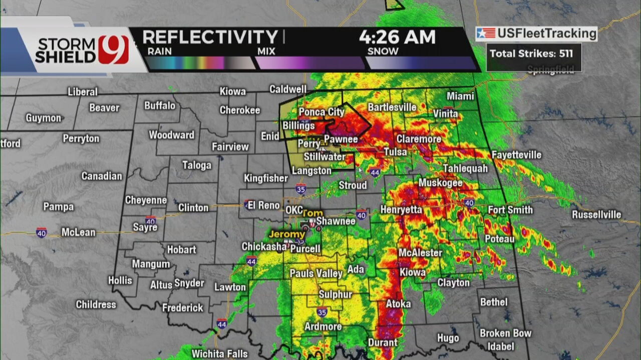
Update 4:21 a.m. 6/10/2022
Severe weather threats continue on Friday morning as the National Weather service has issued a Severe Thunderstorm Warning for Garfield, Logan, Noble and Payne counties until 5:15 a.m. on Friday morning.
The NWS says the people in the path of this storm can expect considerable tree damage. According to the NWS damage is likely to mobile homes, roofs, and outbuildings.
Click Here To View Our News 9 Traffic Map For The latest Traffic Updates
Update 4:09 a.m. 6/10/2022
The National Weather Service has issued a Severe Thunderstorm Warning for Garfield, Grant, Kay and Noble counties until 4:45 a.m. on Friday morning.
The NWS Says this storm has the potential for high wind threats upwards of 70 mph. According to the NWS, people in the path of this storm are advised to seek shelter in an interior room on the lowest floor of a building.
---
Update 3:21 a.m. 6/10/2022
Early-morning storms are moving across parts of the state on Friday.
The National Weather Service (NWS) has issued a Severe Thunderstorm Watch for Atoka, Bryan, Canadian, Carter, Cleveland, Coal, Garvin, Grady, Garfield, Grant, Hughes, Jefferson, Johnston, Kay, Kingfisher, Logan, Lincoln, Love, Marshall, McClain, Murray, Noble, Oklahoma, Payne, Pontotoc, Pottawatomie, Seminole and Stephens counties until 8 a.m. on Friday.
According to the NWS areas in the path of this storm could experience wind gusts upwards of 60 mph and hail stones as large as .75 inches.
The NWS advises anyone in the path of this storm move to an interior room on the lowest floor of a building.

Get The Daily Update!
Be among the first to get breaking news, weather, and general news updates from News 9 delivered right to your inbox!
More Like This
June 10th, 2022

April 19th, 2025


