Cold Pattern Setting Up, Spotty Shower Chances Wednesday
<p>Cooler air will move in for Wednesday. </p>Wednesday, November 7th 2018, 6:31 am

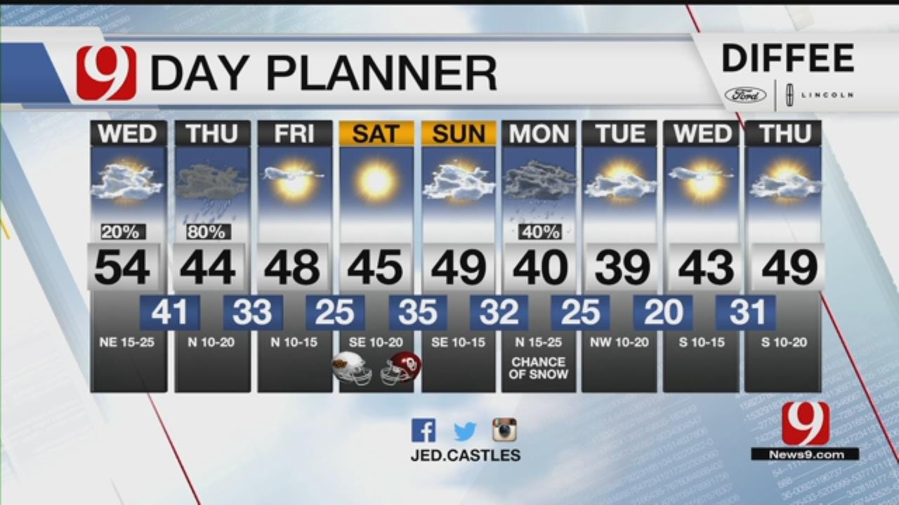
Cooler air will move in for Wednesday with chance for a few spotty showers.
Clouds will be around as a stronger storm moves in on Thursday and brings a statewide light rain back to the state. Colder air will be arriving as well and this will set up a cold and wet forecast.
Some light snow will be possible near the Kansas border with some areas possibly getting a dusting. The coldest morning lows of the season expected Friday into Saturday mornings.
We could see our first freeze Friday but a freeze looks likely on Saturday. A "hard freeze" is expected for some and Oklahoma City is in that threat area. A "hard freeze" is when temps drop to 28 degrees or colder for about 4 hours.
Temps will remain below normal through the middle of next week as several more cold fronts move in.

Get The Daily Update!
Be among the first to get breaking news, weather, and general news updates from News 9 delivered right to your inbox!
More Like This

November 7th, 2018

March 22nd, 2024

March 14th, 2024

February 9th, 2024
Top Headlines

April 26th, 2024
April 26th, 2024

April 26th, 2024

