Arctic Blast On Its Way; Snow Totals Looking Lighter
An arctic blast is still on the way. The latest data does not show the air being as cold, and the storm moving over head will be weaker than previously thought.Thursday, January 17th 2019, 10:37 am
An arctic blast is still on the way. The latest data does not show the air being as cold, and the storm moving over head will be weaker than previously thought.
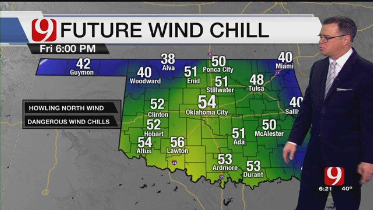
So, snow totals look lighter than what we showed yesterday. The heaviest totals will be possible in NE OK. The wind chill factor will be the biggest inconvenience of the weekend.

Wind chills will dip into the single digits and teens in the morning hours and rebound into the 20s Saturday and 30s Sunday afternoon.
The arctic front is expected to move in quicker and should approach OKC by 9 to 10 pm Friday. Rain will develop late Friday and will transition to snow for a while Saturday morning.

The skies are expected to clear during the day on Saturday. Snow will accumulate to less than 1 inch and it will be a wind driven snow.

At this point the bark will be worse than the bite with this batch of arctic air and storm. Plan accordingly.

Get The Daily Update!
Be among the first to get breaking news, weather, and general news updates from News 9 delivered right to your inbox!
More Like This
January 17th, 2019

March 22nd, 2024

March 14th, 2024

February 9th, 2024
Top Headlines

May 10th, 2024