Oklahoma Severe Weather Update: What You Need To Know For Monday
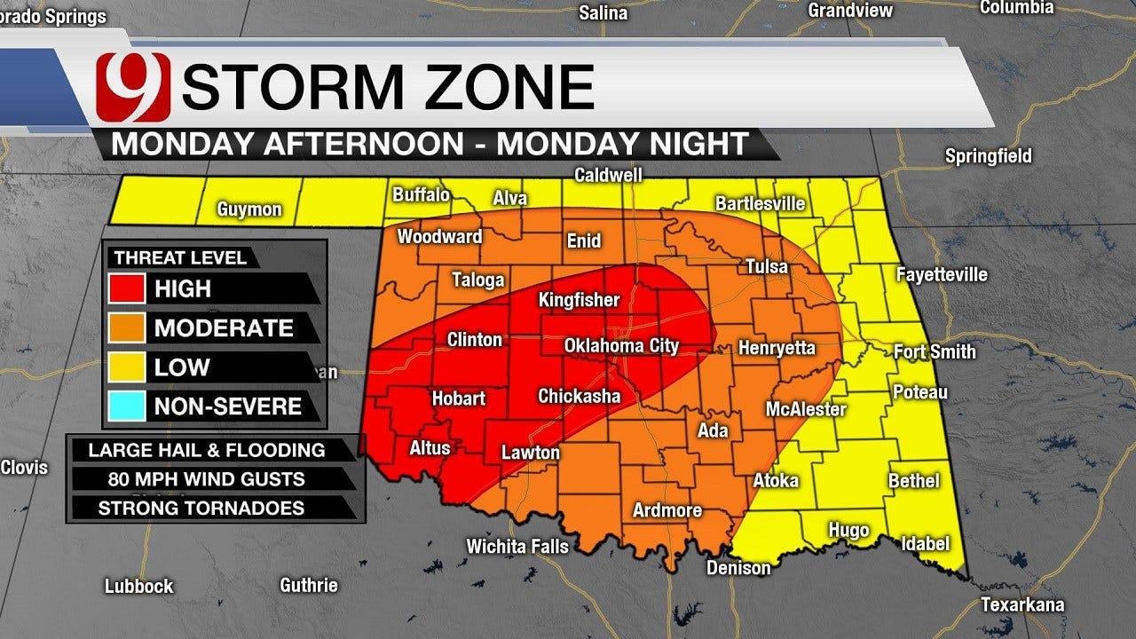
It's May in Oklahoma, and the models suggest that Monday is shaping up potentially to be one of those days we always talk about -- widespread severe weather and possibly strong tornadoes. What do the News 9 meteorologists think is going to happen?Sunday, May 19th 2019, 10:12 am
It's May in Oklahoma, and the models suggest that Monday is shaping up potentially to be one of those days we always talk about -- widespread severe weather and possibly strong tornadoes.
However, what do the News 9 meteorologists think is going to happen?
Here's the latest from meteorologist Justin Rudicel as of 11 p.m. Sunday:
Monday remains looking like a high-end severe weather event. Monday morning, we'll see showers and thunderstorms with a low severe-weather threat for mainly wind and hail. During the afternoon, more storms develop, and the severe weather threat increases. Very large hail and strong tornadoes will be possible through the afternoon and evening. Along with the severe weather, flooding rains will be likely with the cluster of thunderstorms.
Overnight, a line of storms will develop out west and will move from west to east across the state. These storms will be capable of highs winds, hail and a few tornadoes.
But tornadoes are not nearly the only concern. Flooding will likely be a major issue in parts of the state. Here's what Justin had to say as of 11 p.m. Sunday:

Along with the large hail and tornado threat, I'm very concerned about flooding tomorrow. Numerous storms will train over the same areas tomorrow and tomorrow night. With already-saturated grounds and the possibility of seeing rainfall totals 6 to 10 inches possible in places, some serious flooding could take place across central and northern Oklahoma.
Be sure to download the News 9 weather app, and make it a point to join News 9 This Morning from 4 to 7 a.m., and meteorologists Jed Castles and Lacey Swope will cover storms developing during the morning as well as give you a fresh timeline for the rest of the day.
Be safe. Have a plan. And tune in to News 9 throughout the day.
More Like This
March 22nd, 2024
March 14th, 2024
February 9th, 2024
Top Headlines
May 6th, 2024


