Extreme Fire Danger In Effect On Friday For Most Of State
<p>It will be an extreme fire danger day on Friday! </p>Friday, April 13th 2018, 7:51 am


It will be an extreme fire danger day on Friday!
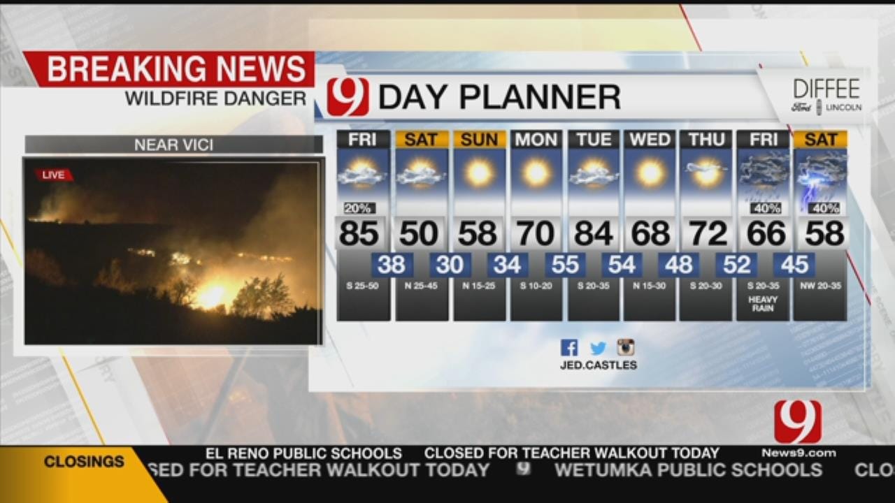
Several big fires developed Thursday in northwest and western Oklahoma. As the dry line shifts further east, the threat extends into central Oklahoma, including Oklahoma City. The dry line will punch east of Interstate 35 by mid-morning, causing our humidity to drop, and add the gusty winds of up to 50 mph and the hot temperatures. Our highs will be in mid-80s for Oklahoma City.
A cold front arrives by late Friday evening and will shift our winds. Colder air is expected and lows drop to the upper 30s.
We will be much colder on Saturday with a more than 30 degree temperature drop! Highs will struggle to hit 50 with partly sunny skies. Gusts will still be high between 30 to 40 mph.
See Also: Current Conditions & 9-Day Forecast
A gusty wind becomes breezy overnight Saturday into Sunday. Lows will reach freezing for much of the state and will be near record lows. Make sure to protect those plants!
Sunday will be quiet with lighter winds and highs near 60.

Get The Daily Update!
Be among the first to get breaking news, weather, and general news updates from News 9 delivered right to your inbox!
More Like This

April 13th, 2018

March 22nd, 2024

March 14th, 2024

February 9th, 2024
Top Headlines


April 25th, 2024
April 25th, 2024