Improving Weather This Weekend
The powerful upper-level system is moving across Eastern Oklahoma this morning along with a stout surface low pressure area along the Red River.Friday, March 3rd 2023, 8:04 am
If you’re into podcasts or in a rush, check out my daily weather update. Search for NewsOn6 and ‘Weather Out The Door’ on most podcast providers, including Spotify, Stitcher and Tune-In, or Click Here to listen on Apple Podcasts.
TULSA, Okla. - Early-morning showers are moving out on Friday, but cool and windy weather sticks around into the afternoon hours.
Here are the details from News On 6 Meteorologist Alan Crone:

The powerful upper-level system is moving across Eastern Oklahoma on Friday morning along with a stout surface low pressure area along the Red River. Some heavy downpours are still ongoing across far southeastern Oklahoma Friday morning with blustery northwest winds and some rain lingering across the northeastern quadrant of the area. The flood watch remains until noon Friday for extreme southeastern Oklahoma. The heavy rainfall with this system will keep some flooding issues along streams, creeks, and rivers for another day or two. Please remain aware of rising waters across the eastern third of the state.

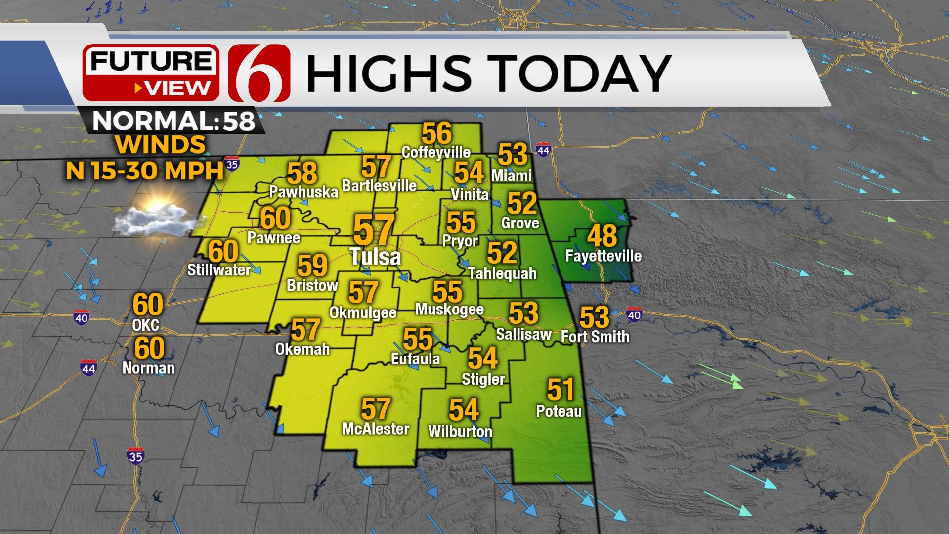
Precipitation will quickly end but the strong northwest winds will remain for a few more hours before decreasing from the west to east by midday and afternoon. Morning clouds will also erode from the west to east as dry air arrives. This promotes sunny skies and temps moving from the 40s this morning into the 50s this afternoon. A few spots may hit the lower 60s west of the metro.

The weekend weather looks good. Saturday morning lows in the 30s and 40s will be followed by afternoon highs in the lower to mid-60s with south winds around 10 to 20 mph. Stronger south winds return Sunday from 20 to 35 mph by the afternoon along with afternoon highs in the lower to mid-70s. Monday features highs in the mid-70s before a cold front approach from the north and impacts at least part of the area with cooler weather Tuesday and Wednesday. A reinforcing surge of cooler air should arrive Wednesday keeping the rest of the week cooler with highs in the upper 40s, but data has not been consistent in these solutions. The upper air flow will be relatively weak, but another disturbance nears Tuesday and Wednesday with at least some low mentions for showers and some thunder. Severe weather is currently not expected. Its not impossible to see some wintry weather possibilities for the latter half of next week across the central plains.

Thanks for reading the Friday morning weather discussion and blog.
Have a super great day!
Alan Crone
KOTV

Get The Daily Update!
Be among the first to get breaking news, weather, and general news updates from News 9 delivered right to your inbox!
More Like This
March 3rd, 2023

April 29th, 2024

April 29th, 2024

April 29th, 2024
Top Headlines


April 29th, 2024

April 29th, 2024

April 29th, 2024
