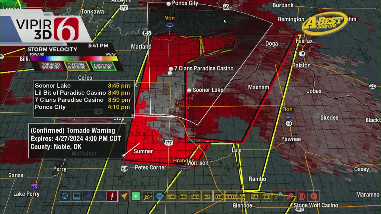
LIVE UPDATES: Tornado Warning For Osage County Until 6 p.m.
Oklahoma Weather Forecast: Bookmark this page and refresh it often for the latest forecast and daily updates.Saturday, April 27th 2024, 9:38 am


TULSA, Okla. -
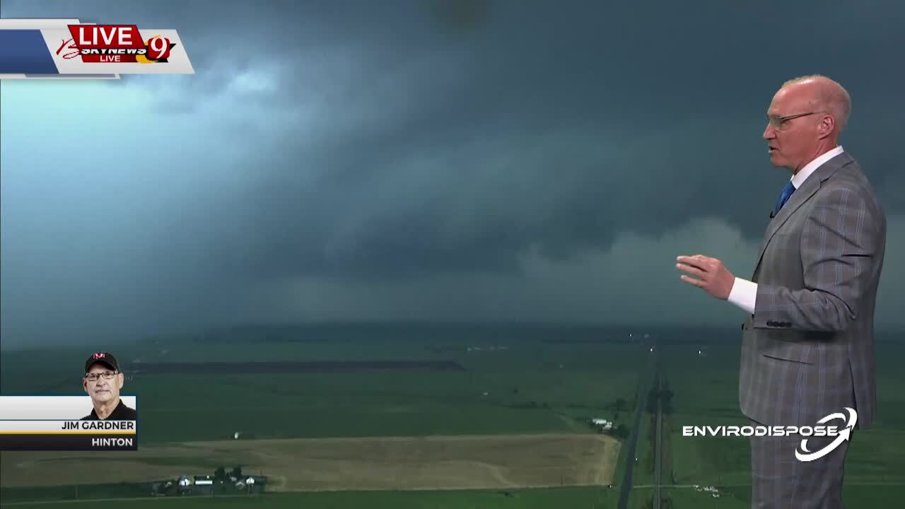
Chief Meteorologist Travis Meyer is live in the Bob Mills Weather Center on Saturday as severe storms move into Green Country.
Active Watches & Warnings:
- Tornado Warning active for Osage County until 6 p.m.
- Severe Thunderstorm Warning for Kay, Noble counties until 5:30 p.m.
- Severe Thunderstorm Warning in Osage County until 5:15 p.m.
- Severe Thunderstorm Warning active in Kay, Noble counties until 4:45 p.m.
---
Another round of severe weather returns to Green Country on Saturday.
This strong storm system arrives around noon near I-35, expanding east, according to Meteorologist Travis Meyer.
This storm brings all modes of severe weather possibilities: Heavy rain, strong wind, hail and tornadoes.
There's also a flooding risk with the massive amounts of rain forecasted.

What Are The Storm Chances For Saturday April 27 in Oklahoma?
A stronger storm system is expected to impact part of the state Saturday afternoon and evening extending into the overnight and early Sunday morning hours. All modes of severe weather will be possible Saturday evening into overnight.
Additionally, heavy rainfall threats will return in some locations creating some localized flooding probabilities, mostly across southeastern and east-central OK.
Storm severity may relax some during the pre-dawn Sunday hours but may increase by afternoon along and east of highway 69 into western Arkansas.
Data Friday morning suggests some additional shower and storm chances may now arrive by Monday night into Tuesday morning of next week.
A powerful upper-level trough is now ejecting northeast into the central plains and Midwest by early afternoon. As the stronger forcing moves northeast Friday morning, the storm activity currently moving across eastern OK should continue to move out of the region.
Most hi-resolution and convective allowing models suggest the potential for additional redevelopment later this afternoon and evening will be across a narrow area. We’ll encourage you to remain aware of the weather later tonight for this scenario.
It was a bumpy Friday morning as severe weather moved through Northeast Oklahoma. Although the storms have passed for now, there is more active weather expected this weekend.
Outages Across Oklahoma:
Northeast Oklahoma has various power companies and electric co-operatives, many with overlapping areas of coverage. Below is a link to various outage maps.
Indian Electric Cooperative (IEC) Outage Map
Oklahoma Association of Electric Cooperatives Outage Map - (Note Several Smaller Co-ops Included)
What are the storm chances this weekend in Oklahoma?
Saturday morning to midday there will be a slight chance of a few showers or storms developing in the warm sector across central and eastern OK as strong southeast winds continue from 20 to 40 mph.
The next powerful upper air trough will be advancing eastward and may also trigger a few showers or storms by early afternoon along and west of I-35.
A dry line is expected to be located across west-central OK where additional super cellular storms are likely to develop by late afternoon and early evening. This activity will move northeast across part of central OK and eventually enter sections of eastern OK Saturday evening.
All modes of severe weather will be likely. As the low-level jet strengthens shortly after sunset, the potential for tornadic activity may increase.
Later in the evening, storms will tend to form line segments as the upper flow becomes more parallel to a weak pacific front that will overtake the dry line as it moves west to east. The severe threats will continue but also morph into a heavy rainfall and flash flooding chance for some locations.
Some of these storms may persist into the overnight hours into early Sunday morning but should also gradually weaken as they slowly move east after early Sunday morning.
There will remain a chance for some redevelopment Sunday afternoon across the far eastern sections of the state, but greater upper-level forcing will be slightly north of the region.
The Alan Crone morning weather podcast link from Spotify:
https://open.spotify.com/episode/5j0ovActG8BZCOTqZQzrfU
The Alan Crone morning weather podcast link from Apple:
https://podcasts.apple.com/us/podcast/weather-out-the-door/id1499556141?i=1000646589555
Follow the News On 6 Meteorologists on Facebook!

Get The Daily Update!
Be among the first to get breaking news, weather, and general news updates from News 9 delivered right to your inbox!
More Like This

April 27th, 2024

April 27th, 2024

April 27th, 2024
Top Headlines

April 27th, 2024

April 26th, 2024

April 26th, 2024
