LIVE UPDATES: 1 Killed After Tornado Hits Barnsdall; Tornado Warning Active In Creek, Okmulgee Counties
Oklahoma Weather Forecast: Bookmark this page and refresh it often for the latest forecast and daily updates.Tuesday, May 7th 2024, 12:40 am


TULSA, Okla. -
A large tornado hit the northeast Oklahoma town of Barnsdall Monday night resulting in one confirmed fatality, according to Osage County Sheriff Eddie Virden.
This system was one of several severe storms that moved across the News On 6 viewing area throughout the evening.
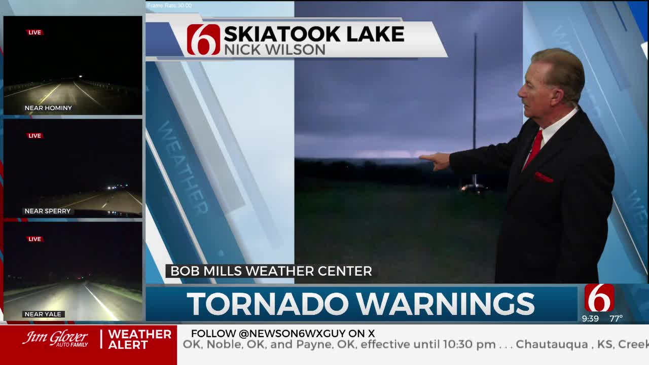
WATCH LIVE: Severe Weather Coverage With Travis Meyer
There was no confirmation as to damage or injuries from the tornado. The storm was moving to the northeast.
Sheriff Eddie Virden told News On 6 that as of 11 p.m., there are no confirmed fatalities. He confirmed extensive damage reports in Barnsdall and said Highway 123 will be shut down.
There are confirmed reports of numerous injuries and widespread damage, according to Osage County Emergency Management. OCEM said many people are believed to be trapped in their homes and that downed power lines are making it difficult to respond.
County officials are working to clear the roads.
Washington County Emergency Management said Highway 75 is blocked in both directions north of Frank Phillips and south of Tuxedo due to debris.
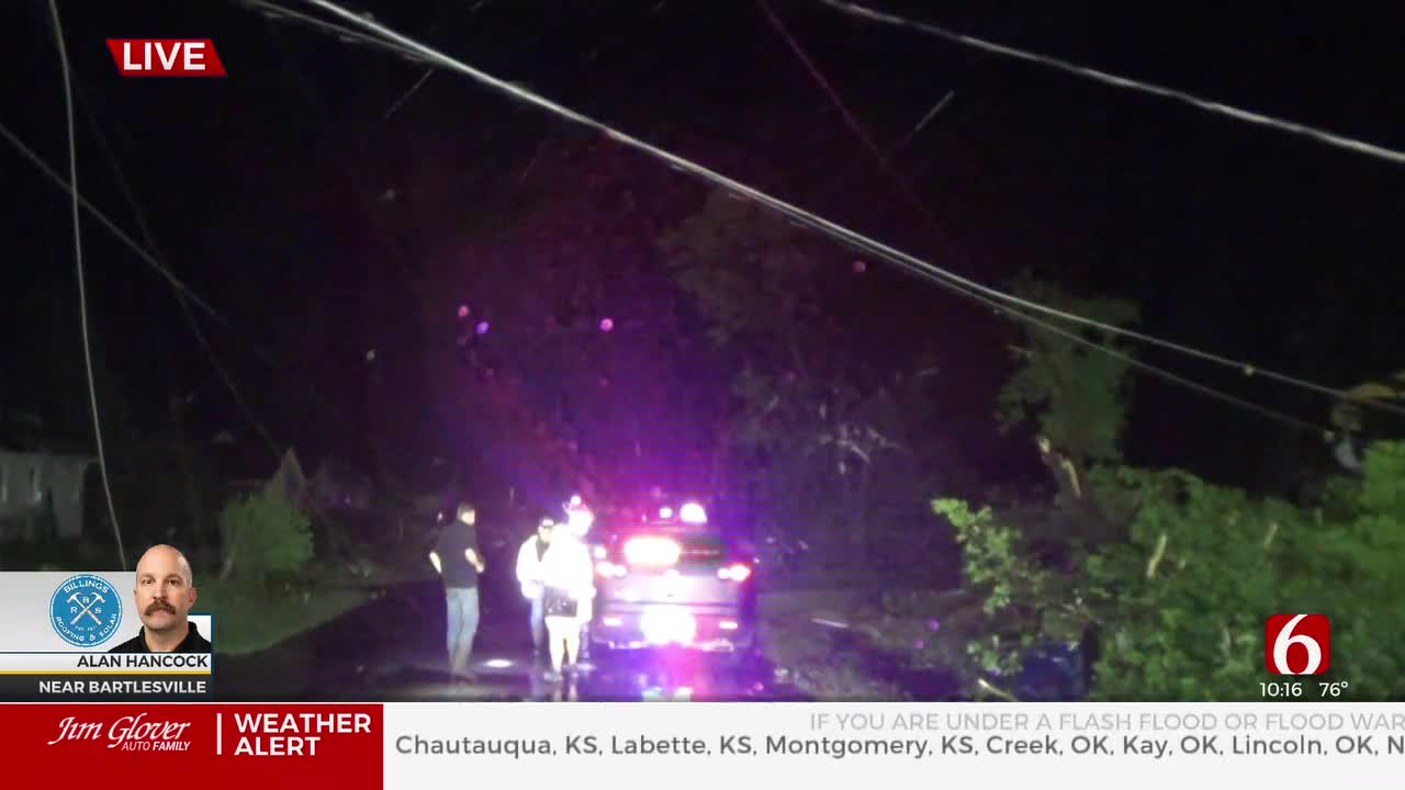
That tornado also progressed into parts of Bartlesville around 10 p.m. News On 6 storm tracker Alan Hancock was on the east side of downtown Bartlesville and captured heavy damage to a hotel.
B the Light Mission in Bartlesville said their mission is open for shelter. That location is at 219 North Virginia.
Active Watches & Warnings
- Severe Thunderstorm Warning for Muskogee, Okmulgee counties until 1:30 a.m.
- Tornado Watch for Lincoln, Okfuskee, Okmulgee, Wagoner counties until 3 a.m.
- Severe Thunderstorm Warning for Creek, Okfuskee and Okmulgee counties until 12:45 a.m.
- Tornado Watch for Adair, Cherokee, Delaware, Haskell, Hughes, Latimer, LeFlore, McIntosh, Mayes, Muskogee, Ottawa, Pittsburg, Pushmataha and Sequoyah counties until 5 a.m.
- A Tornado Watch has been issued for Creek, Kay, Lincoln, Noble, Okfuskee, Osage, Pawnee, and Payne County until 11:00 pm. There is also a watch for Chautauqua County in Kansas until 11:00 p.m.

What is the weather outlook for this week in Oklahoma?
Severe weather threats are expected for part of Northeastern OK with this storm system by later Monday afternoon, continuing into the evening, and possibly for a few overnight hours before shifting away from the region. All modes of severe weather will be possible.
Another moderately strong disturbance arrives Tuesday night into early Wednesday morning with additional severe weather threats along and southeast of I-44 starting Wednesday morning and continuing through the afternoon.

After the front moves across the area Wednesday morning to afternoon, we're expecting a break for a few days with cooler and drier air arriving across the state.
A surface ridge of high pressure will settle near the northern OK vicinity Thursday into Friday bringing sunshine, light winds, and below normal, yet pleasant weather.
A disturbance may be near the state for part of the weekend that could bring a few showers yet with cooler weather remaining. We'll have more on this scenario Tuesday.
What Is A PDS Tornado Watch?
PDS stands for "Particularly Dangerous Situation." A PDS Tornado Watch means that the storms that do form will be able to produce potentially long-lived, significant tornadoes.
What are the chances for severe weather in Oklahoma on Monday, May 6?
A powerful upper-level system will be near the region Monday. Strong southeast surface winds from 15 to 30 mph will continue bringing ample low-level moisture into the state with afternoon highs reaching the upper 70s to lower 80s across the eastern third of the state.
A dry line will be positioned across far western OK with increasing instability along and east of this feature by this afternoon and evening.
A weak mid-level cap is expected to suppress any surface-based thunderstorm activity this morning to midday, but a few areas of scattered storms will be possible this afternoon across eastern OK, including a low-threat of severe storms.

By 3pm to 5pm, discrete supercell storms will attempt to develop along and east of the dry line across west central to northwestern OK. As strong upper-level winds arrive over the region, deep layer and speed shear will increase allowing storms to rapidly become severe. These discrete storms will have the greater potential for producing very large hail and possibly a strong, long track tornado.
Later in the evening, storms will be more likely to congeal into at least one or possibly a few line segments and move eastward transitioning to a damaging wind threat with some embedded tornadic activity.

Due to recent heavy rainfall, flooding is possible in a few locations. Streams and creeks will also rise again over the next few days.
We're encouraging you to remain aware of your weather surroundings tonight as this system nears your area. Be sure to have a severe weather safety plan in place in case warnings are issued for your area.
Outages Across Oklahoma:
Northeast Oklahoma has various power companies and electric co-operatives, many with overlapping areas of coverage. Below is a link to various outage maps.
Indian Electric Cooperative (IEC) Outage Map
Oklahoma Association of Electric Cooperatives Outage Map - (Note Several Smaller Co-ops Included)
The Alan Crone morning weather podcast link from Spotify:
https://open.spotify.com/episode/5j0ovActG8BZCOTqZQzrfU
The Alan Crone morning weather podcast link from Apple:
https://podcasts.apple.com/us/podcast/weather-out-the-door/id1499556141?i=1000646589555
Follow the News On 6 Meteorologists on Facebook!

Get The Daily Update!
Be among the first to get breaking news, weather, and general news updates from News 9 delivered right to your inbox!
More Like This

May 7th, 2024

May 7th, 2024
May 6th, 2024
Top Headlines
May 7th, 2024