Pleasant Weather For Most This Weekend Before Rain Chances Return Sunday Night
Oklahoma Weather Forecast: Bookmark this page and refresh it often for the latest forecast and daily updates.Friday, May 10th 2024, 9:50 am
TULSA, Okla. -
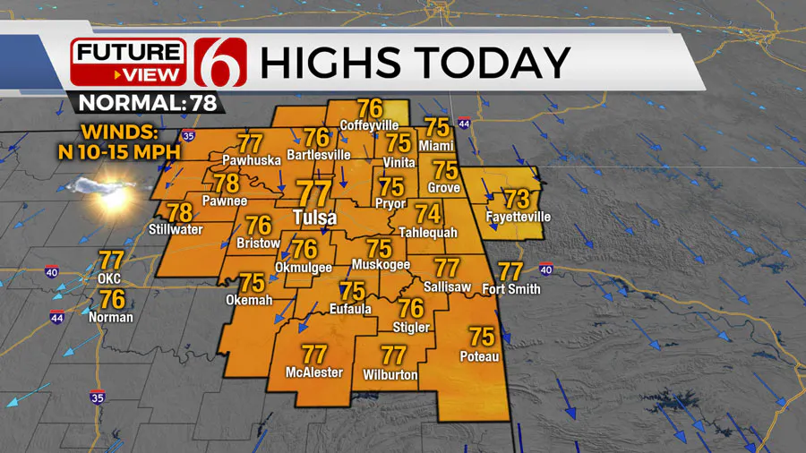
A surface ridge of high pressure will be near the region Friday bringing north winds, sunshine, and highs in the mid-70s. We’ll see a few clouds at times but will expect pleasant and calm weather.
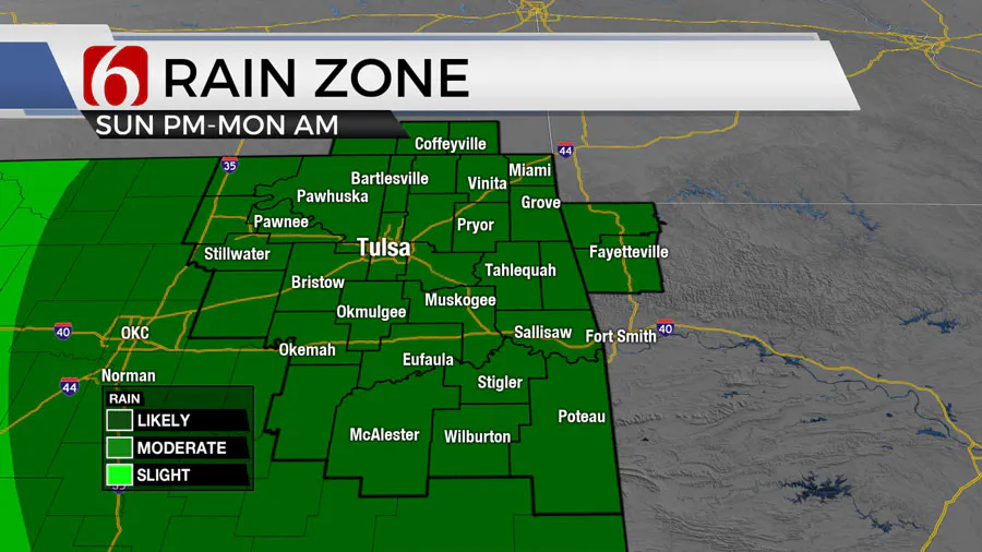
A mostly weak upper-level system will be near our area by the latter half of the weekend bringing rain and storm chances late Sunday evening into Monday.
Another system is possible for the latter portion of next week with another round of showers and storms, mostly Thursday, but some inconsistencies in data may change the timing for this system.
What will the weather be like in Oklahoma on Friday, May 10?
Highs Friday reach the lower to mid-70s with a sunshine and cloud mix. This weekend features lows in the 50s and highs in the upper 70s and lower 80s.

The main upper-level pattern has been characterized by a cut-off low positioned across the central plains last week that has retrograded to part of Southern Nevada Friday morning.

This feature will get a kick back into the southern flow as a mid-level trough emerges from southern Canada into the upper Midwest and Great lakes region Friday and Saturday.
What are the storm chances next week in Oklahoma?
The former stalled cut-off will travel will move slowly eastward, nearing the southern plains Saturday and Sunday and passing over NE Oklahoma Monday. This system brings showers and storms to the western half of Oklahoma on Sunday.
Most of these will remain to our west for most of the day but will begin migrating closer to eastern OK by evening. The upper flow will be rather weak and severe weather threats will remain relatively low but not zero.

As the low passes over our area on Monday, some additional showers and storms will remain possible for the first part of the day before moving out of the area by afternoon.
Upper flow will be stronger across the Red River Valley Monday afternoon and a few strong to severe storms may be possible across southeastern OK and northeast TX during this period.
As the system exits the area, we should get a break for Tuesday and most of Wednesday before another stronger developing trough is likely to arrive Thursday with increasing thunderstorm chances, including some severe threats before exiting Friday.
Outages Across Oklahoma:
Northeast Oklahoma has various power companies and electric co-operatives, many with overlapping areas of coverage. Below is a link to various outage maps.
Indian Electric Cooperative (IEC) Outage Map
Oklahoma Association of Electric Cooperatives Outage Map - (Note Several Smaller Co-ops Included)
The Alan Crone morning weather podcast link from Spotify:
https://open.spotify.com/episode/5j0ovActG8BZCOTqZQzrfU
The Alan Crone morning weather podcast link from Apple:
https://podcasts.apple.com/us/podcast/weather-out-the-door/id1499556141?i=1000646589555
Follow the News On 6 Meteorologists on Facebook!

More Like This
May 10th, 2024
May 10th, 2024
Top Headlines
May 10th, 2024
May 10th, 2024
May 10th, 2024


