Chilly, Soggy Tuesday; Wednesday Severe Storm Chances Return
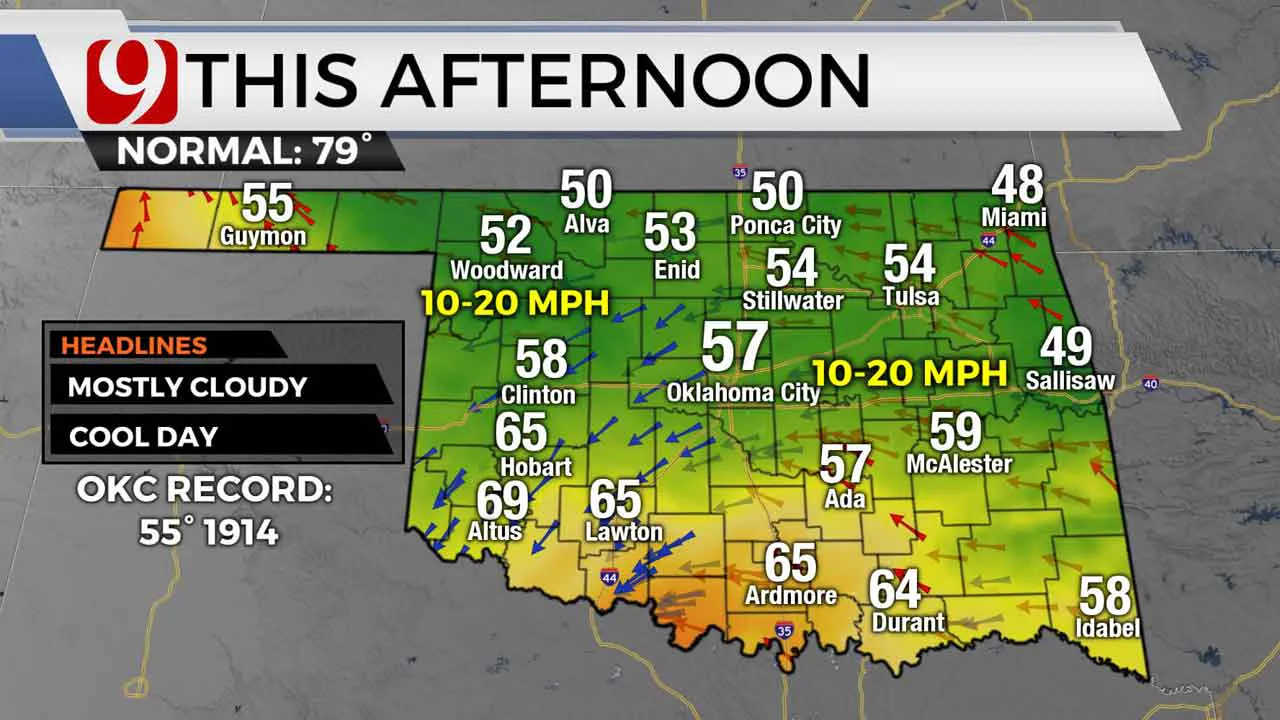
Chilly and soggy start to the day Tuesday. Highs Tuesday will struggle to make it out of the 50s in many locations. Look for mostly cloudy skies and showers to the southeast in the afternoon.Tuesday, May 12th 2020, 6:26 am
Chilly and soggy start to the day Tuesday.
Highs Tuesday will struggle to make it out of the 50s in many locations. Look for mostly cloudy skies and showers to the southeast in the afternoon.
Highs will be close to record cold for Oklahoma City. The current record cold high for May 12 is 55 set back in 1914.
Tuesday night a warm front lifts in and Gulf moisture makes a return. This will be fuel for thunderstorms Wednesday.
On Wednesday, look for a warm muggy day with highs in the 70s and 80s.
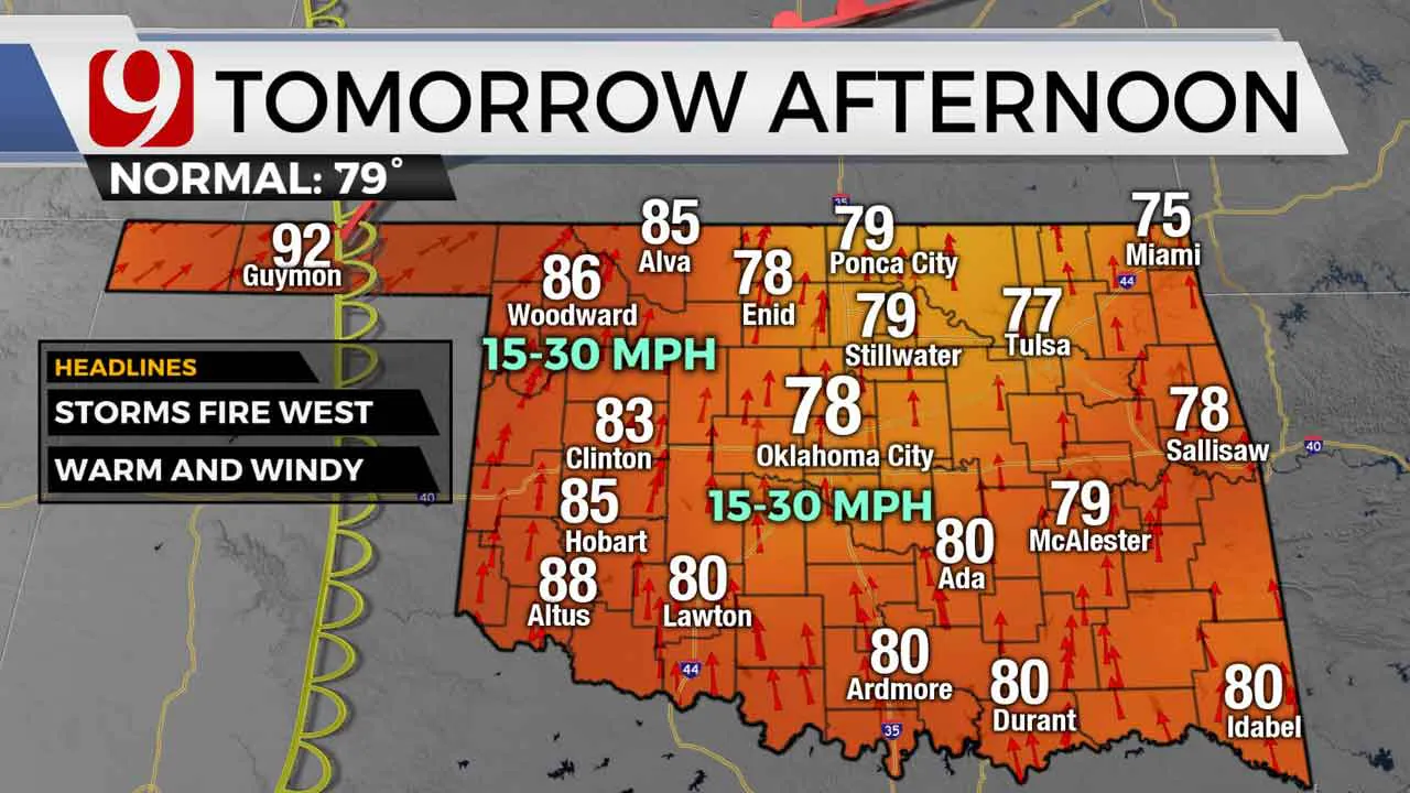
A dryline will setup out west and storms will fire along that boundary. Storms will move into western Oklahoma around 5 p.m. Wednesday.
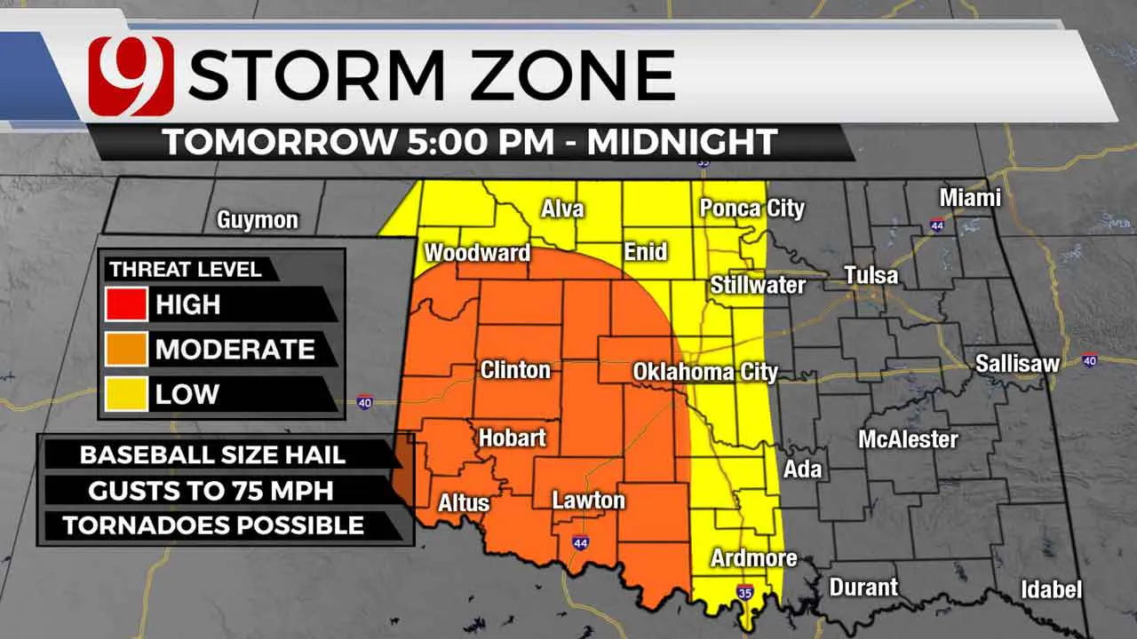
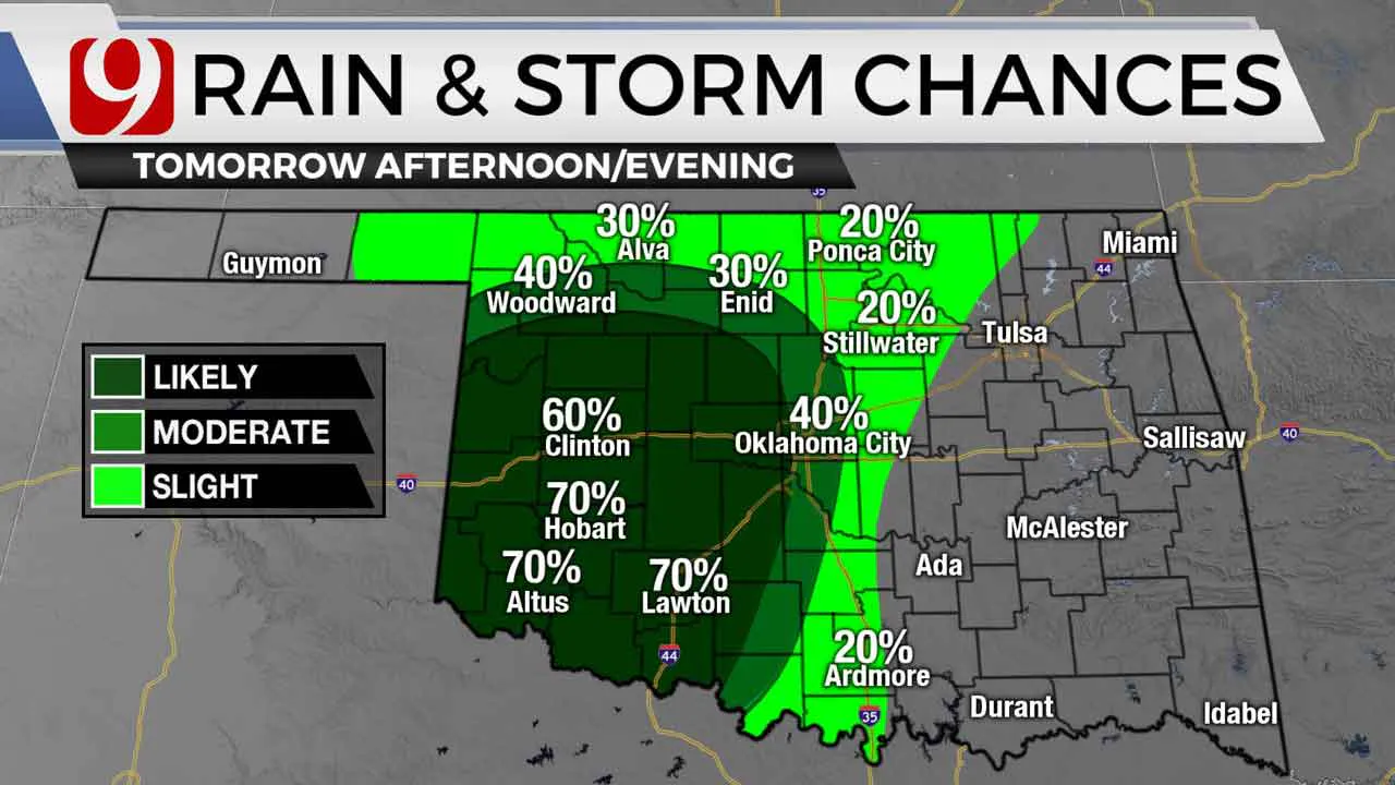
Large hail, damaging winds, and tornadoes will be possible.
Isolated storms will be monitored very closely for a slightly higher tornado threat.
As the evening rolls along, storms will try to form into a squall line. This will pose more of a wind and hail threat.
We will monitor the storms from start to finish and keep you advised.
More Like This
May 12th, 2020
March 25th, 2024
March 1st, 2024
February 2nd, 2024
Top Headlines
April 16th, 2024
April 16th, 2024
April 16th, 2024


