Winter Storm Still On Track To Have Potentially Big Impact On Oklahoma
After a night in the lower 20s and single digit wind chills, temps will stay below freezing until Friday. Wind chills will stay in the teens and 20s.Tuesday, January 1st 2019, 10:47 am
After a night in the lower 20s and single digit wind chills, temps will stay below freezing until Friday. Wind chills will stay in the teens and 20s.
The latest overnight data shows the winter storm still on track to have a potentially big impact on Oklahoma, mainly on Thursday. Skies will stay mostly cloudy through Tuesday and Wednesday. Wednesday afternoon and evening, precipitation will begin in southern Oklahoma as a freezing rain/sleet mix.
With temps already below freezing all through Oklahoma, impacts will likely be felt right away for those who see precipitation, mainly in southern/southeast Oklahoma. OKC may see some light precipitation, but most of the impact will begin overnight Wednesday into Thursday.
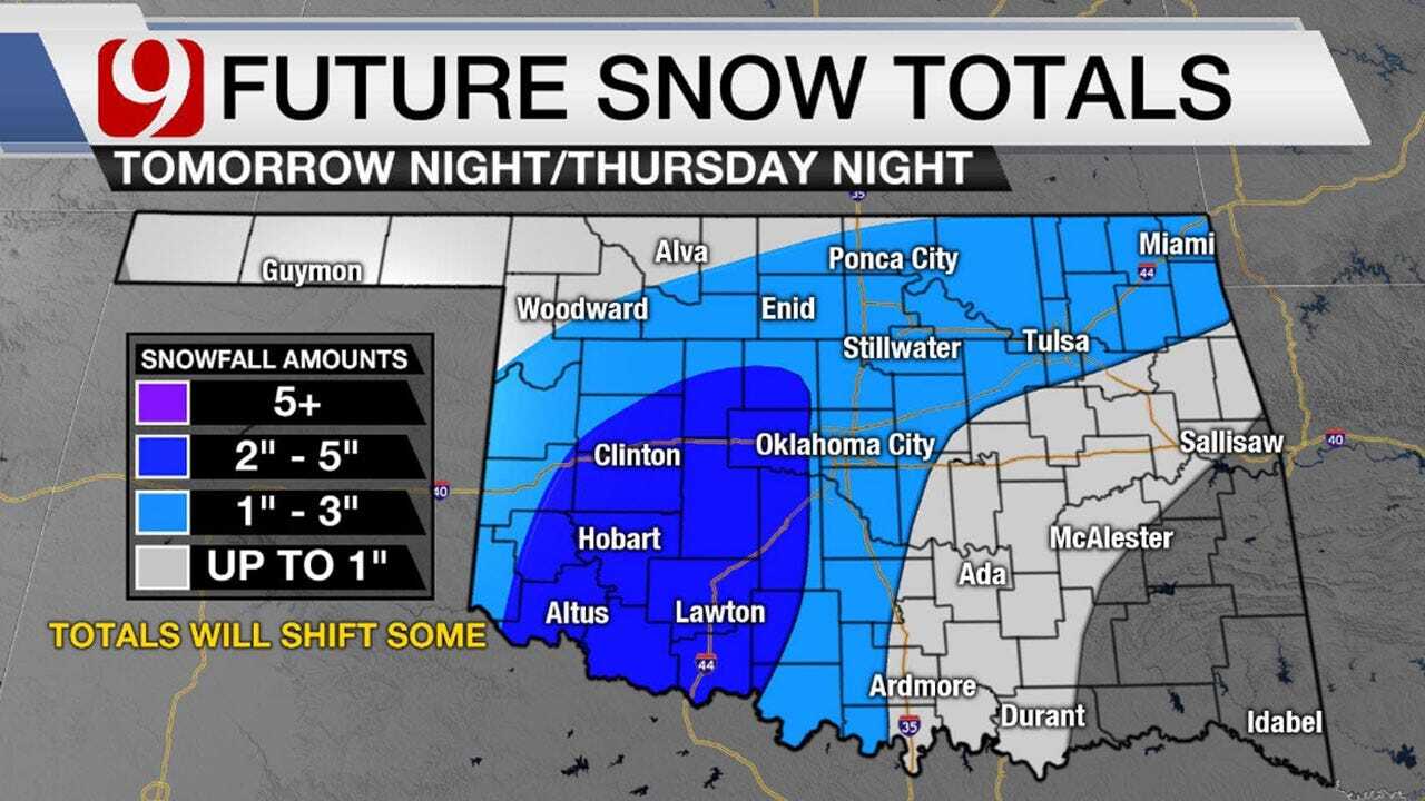
The latest overnight data and some morning data bring a batch of freezing rain into southwest Oklahoma just after midnight followed by snow. That area of precipitation moves into central Oklahoma Thursday morning as ice to begin with before transitioning to snow during the rest of the day.
For now, the highest totals appear to be in western and southwestern Oklahoma. If the low maintains its current track, some totals could be significant out west.
Timing isn’t as much of an issue as placement and precipitation type. The more ice there is, the less snow there will be. Travel could be impacted in southern Oklahoma on Wednesday and for the rest of us on Thursday.
Stay with News 9 for the latest information and any possible changes to the timeline, location for winter precipitation.
More Like This
January 1st, 2019
March 22nd, 2024
March 14th, 2024
February 9th, 2024
Top Headlines
April 19th, 2024
April 19th, 2024
April 19th, 2024


