Warming Trend This Week; Arctic Blast This Weekend
We’re in for a warming trend this week. Highs will top out in the 60s by Friday afternoon. Friday night the bottom falls out as arctic air invades the state. This will bring strong north winds and plummeting temperatures. Wind chills below zero by STuesday, January 15th 2019, 8:22 am
We’re in for a warming trend this week. Highs will top out in the 60s by Friday afternoon.
Friday night the bottom falls out as arctic air invades the state. This will bring strong north winds and plummeting temperatures.
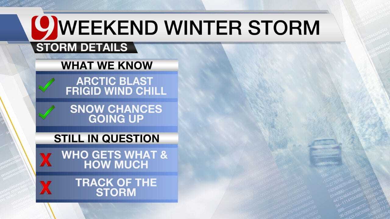
Wind chills below zero by Sunday morning. It isn’t just cold air moving in this weekend. This will be timed with a powerful upper level storm.
Friday we will have a chance for rain and t-storms. Best chances will be in eastern OK. As the cold air moves in, rain will likely change over to snow.
As of now, the heaviest snowfall totals look to be in Kansas and northern OK, but it's still too far out to pin down the exact track and totals.
The one thing that is locked in, the coldest temperatures of the season are on the way.
We will keep you updated as the storm creeps closer to us. Stay with News9, we’ll keep you advised.


Get The Daily Update!
Be among the first to get breaking news, weather, and general news updates from News 9 delivered right to your inbox!
More Like This
January 15th, 2019

March 22nd, 2024

March 14th, 2024

February 9th, 2024
Top Headlines
April 18th, 2024

April 18th, 2024


