Much Colder Weather, Rain Headed To Oklahoma For Friday
Warm today, gone tomorrow -- at least across the Sooner State it is. A big cold front will be moving through Oklahoma Thursday night, bringing a 30-plus degree difference in temperatures in a day. Chief Meteorologist David Payne said that cold front was still in southern Kansas as of 4 p.m., meaning Oklahomans get to enjoy the 70s for a while longer. It made it up to 80 degrees in Tulsa. The record temperature for this date in Oklahoma City is 81, set back in 1954. See Also: Curren...Thursday, February 15th 2018, 6:16 pm

Warm today, gone tomorrow -- at least across the Sooner State it is. A big cold front will be moving through Oklahoma Thursday night, bringing a 30-plus degree difference in temperatures in a day.
Chief Meteorologist David Payne said that cold front was still in southern Kansas as of 4 p.m., meaning Oklahomans get to enjoy the 70s for a while longer. It made it up to 80 degrees in Tulsa.
The record temperature for this date in Oklahoma City is 81, set back in 1954.
See Also: Current Conditions & 9-Day Forecast
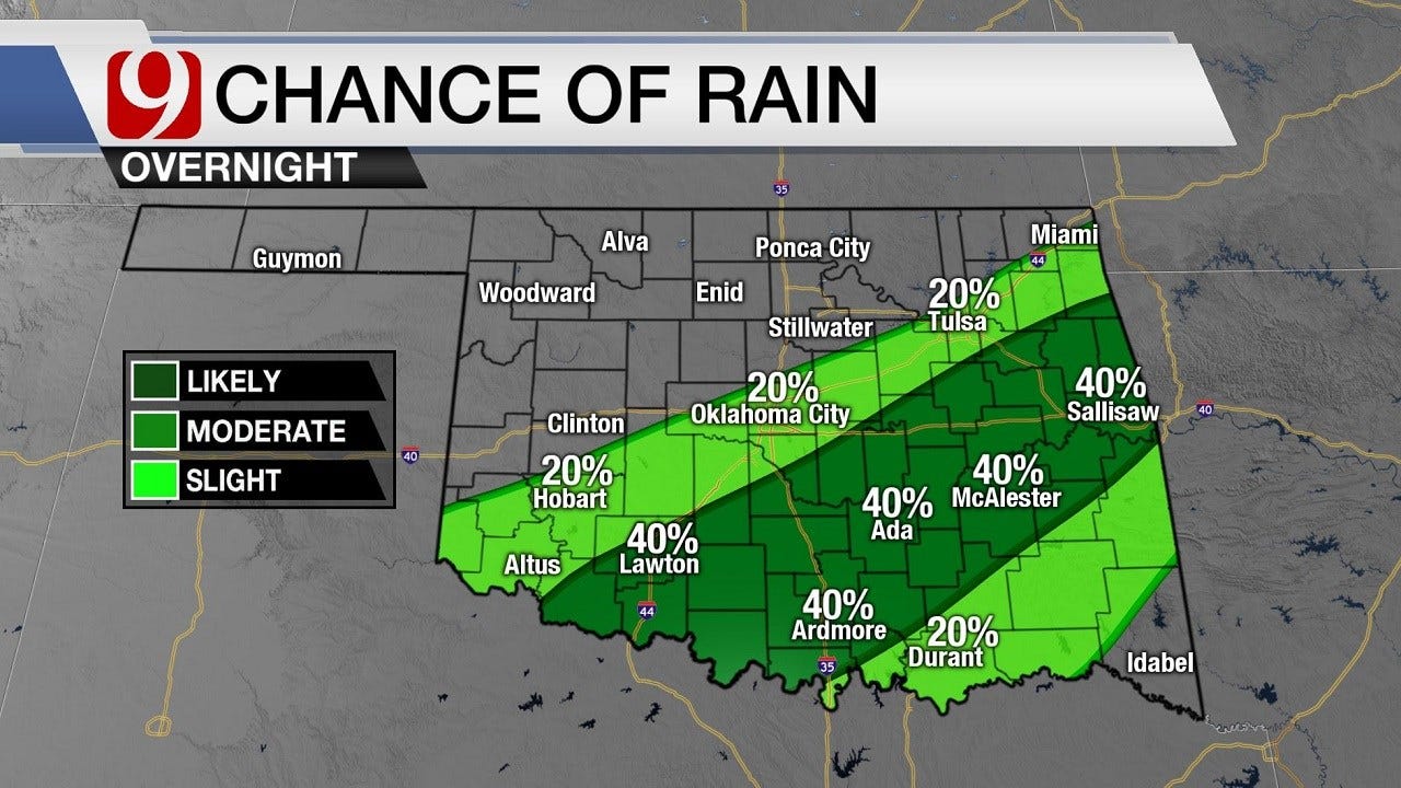
The only downside to a spring-like day such as this were winds up to 20 mph, which aren't uncommon across Oklahoma. The fire danger remains quite high for the rest of the evening, at least until some rain falls, which it might do in parts of the state tonight.
Showers tonight, David says, but the more significant rain will happen Friday night with a stronger storm. It will be dry during the day, and the wet stuff won't last all weekend. Rain will fall Friday night and be done Saturday morning -- and it's only expected to affect the southeastern half of the state, from Oklahoma City, south to Ada and Ardmore, to McAlester and all the way to McCurtain County, where they could see up to three-quarters of an inch of rain.
Nothing severe is expected.
For Oklahoma City and the KWTV viewing area, we'll see anywhere from a quarter to a half inch with some places, such as far southeastern Oklahoma (e.g., Idabel) seeing nearly a full inch. But that all happens Friday night into Saturday.
As for Thursday night, it's going to get much colder and much windier. Expect morning temperatures to be in the mid-30s and for it to be super windy.

Get The Daily Update!
Be among the first to get breaking news, weather, and general news updates from News 9 delivered right to your inbox!
More Like This
February 15th, 2018

March 22nd, 2024

March 14th, 2024

February 9th, 2024
Top Headlines

April 18th, 2024

April 18th, 2024


