Hot And Humid With Temps In The Low 90’s
<p>Storm activity moves out in the metro Thursday morning, but northern and northeast Oklahoma will still see storm activity until about mid-morning. </p>Thursday, May 31st 2018, 7:42 am

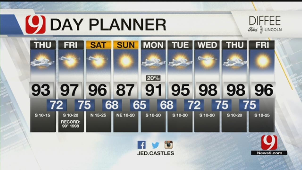
Storm activity moves out in the metro Thursday morning, but northern and northeast Oklahoma will still see storm activity until about mid-morning.
Temperatures Thursday morning will be in the low 70s to mid 60s; cooler in places where it has rained overnight. Thursday will see decreasing clouds, and drying out. Storm chances exit by mid-morning.
Highs are hot in the low 90s but will be hotter in western Oklahoma, from the upper 90s to 100. It will be mostly sunny in the afternoon. Thursday night will be quiet with mainly clear skies. Temperatures will drop into the low to mid 70s.
Friday will turn hotter with highs in the mid 90s with sunny skies. Friday night dry conditions are expected. Lows will be in the mid 70s, warm and muggy.
Saturday during the day will remain hot, ahead of a cold front. Highs push the mid to upper 90s for parts of the state. A cold front arrives late evening time. No rain or storms expected.
Sunday will not be as hot! A brief break from the heat is expected. Highs in the upper to mid 80s.
Next week will see a few days with storm and rain chances, as temperatures rebound back into the 90s and mainly stay in the 90s all week long for the first full week of June.

Get The Daily Update!
Be among the first to get breaking news, weather, and general news updates from News 9 delivered right to your inbox!
More Like This

May 31st, 2018

March 22nd, 2024

March 14th, 2024

February 9th, 2024
Top Headlines

April 18th, 2024

April 18th, 2024

April 18th, 2024

