Snow Falling Across Western And Central Oklahoma
<p>A second round of arctic air is moving in today.</p>Thursday, January 5th 2017, 5:44 am


7:20 a.m.
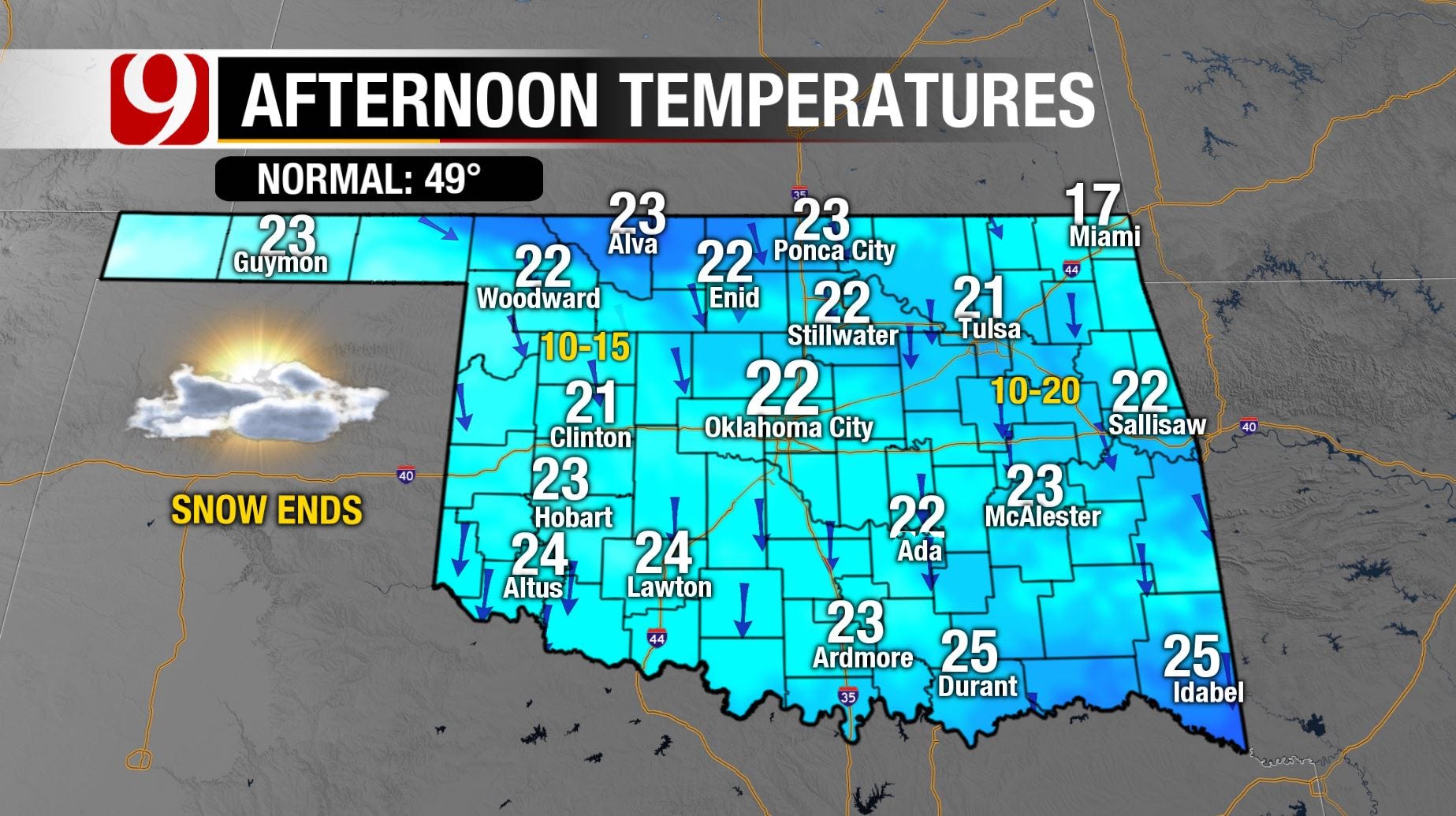
Periods of light to moderate snow will continue across central and southern Oklahoma for the rest of the morning. By lunchtime, most of the snow will have ended for most of state except for the far southern parts of the state. Temperatures will remain in the teens and low 20s as skies become partly cloudy by mid-afternoon. So with the sun’s radiation we’ll likely see some melting on the main roads this afternoon. Otherwise a cold afternoon as snow starts to tamper off by noon. Enjoy your snow day!
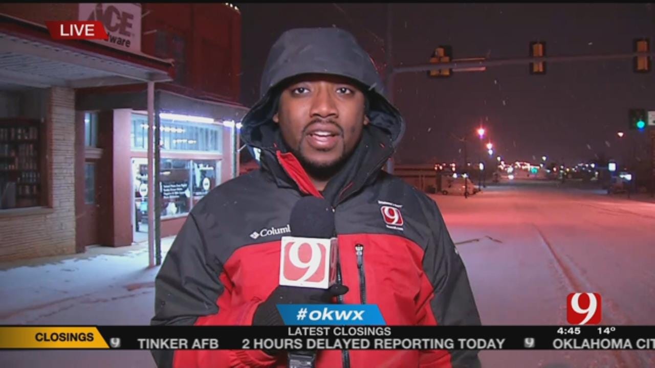
5:16 a.m.: It's a winter wonderland on this Friday morning across central Oklahoma as snow continues to fall.
Travel advisories continue across a good portion of the state for snow-covered and very slick road conditions throughout the morning. Periods of snow will continue through mid-morning across Oklahoma City before starting to weaken and moving south by lunchtime. The best chance of seeing the heavier snows will run through mid-morning but by lunchtime only flurries will be left.
Thankfully, winds will remain fairly light at 10-20 mph but still strong enough to produce single digit wind chills throughout the day. Temperatures will not warm up too much during the day, with highs struggling to reach the lower 20s. Clouds will likely break up a little this afternoon to give us some sunshine for parts of the area.
4:10 a.m.: Another wave of light to moderate snow moving east into the metro. Total snowfall by this afternoon could be as much as 3 inches in the metro, with some isolated areas receiving four inches.
1/6/12 1:30 a.m.: SNOW IS HERE! The heaviest band is moving to the east just north of I-40. So far some of the totals have topped out near 2". Limited visibility and blowing snow.
--
4:30 p.m.: Snow is on the way and will likely cause some very slick conditions later Thursday night and Friday morning.
A travel advisory will be in effect overnight and through Friday morning. Here this evening, it’ll be mainly just cold & clouds across the area. Wind chills will be in the single digits as north winds continue at 10 to 20 mph.
Temperature overnight continue to fall into the middle teens, so they’ll be no doubt that it’ll be all snow that falls overnight. Flurries and light snow starts to develop across western and northwest Oklahoma later Thursday evening. A few flurries will be possible across the OKC metro this evening but the steady snow doesn’t arrive till after midnight.
Once the snow arrives in your location it will become moderately heavy at times. Quickly accumulating on the roads and making them slick and hazardous. The snowfall will be steadiest and heaviest during the overnight across the area.
By Friday morning the snow will start to weaken and drift off to the south. By Friday afternoon, skies could actually become partly to mostly sunny. However, temperatures will remain very cold with highs only in the 20s.
We do some have much warmer temperatures arriving as we head into next week! Stay warm everybody & we’ll keep you posted through the night on the snow moving across the area.
11:30 a.m.: Light snow is already falling in Woodward! Snow showers will move into far western Oklahoma Thursday evening and spread east across the state overnight into Friday morning.
The heaviest snow of up to 4 inches will stay in the panhandle and parts of western Oklahoma. There will be a band of up to 2 inches that sets up in central Oklahoma.
Right now, it looks like the metro will see at least an inch of snow with locally higher amounts of up to 2 inches, especially in the south metro.
Roads will become slick overnight, especially out west. Give yourself some extra time in the morning when heading out. A travel Advisory has been issued for western and central Oklahoma through noon Friday. Dress in layers! Wind chills will be in the low teens and single digits Friday.
10:05 a.m.: Snow should push into far western and northwestern Oklahoma this evening. The snow will hit the OKC metro after midnight. It will snow all night from light to moderate with a few heavy bands mixed in. The snow will wind down gradually Friday morning.
The heaviest snow is expected to fall across western Oklahoma, about 2-4 inches. There will also be a band of snow either along or south of I-40 that will produce 1-2 inches. OKC will be right on the edge of this, giving OKC about an inch but it might be a little more or a little less depending on the exact location of the band. Either way, snow and blowing snow on the roads will make tomorrow morning less than ideal, especially from the metro west and southwest.
Clearing skies tomorrow night will put lows in the single digits but we will jump above freezing Saturday afternoon.
4:45 a.m.: A second round of arctic air is moving in today. This will drop the soil temps as well as the road temperatures and allow our upcoming snow to stick.
Highs will only be in the 20s with wind chills remaining in the teens. Late this evening, snow chances will increase in far NW OK.
The snow will slowly move across the state overnight. Heaviest bands look to stay along and just south of I-40. Highest totals in the panhandle and in far southwest OK.
The north side of the OKC Metro is expected to pick up about 1/2 inch of snow, with 1 to 2 inches on the south side. Roads will likely become slick and hazardous under those heavier bands.
Wind chills Friday morning will range from -15 to 10 degrees. Should see some improvement to the roads by Friday afternoon.
This storm is still a state away, so please stay tuned for updates.
Stay with News9, we will keep you advised.

Get The Daily Update!
Be among the first to get breaking news, weather, and general news updates from News 9 delivered right to your inbox!
More Like This

January 5th, 2017

March 22nd, 2024

March 14th, 2024

February 9th, 2024
Top Headlines


April 25th, 2024

April 25th, 2024
