City Of Tulsa Releases New Flood Zone Map
The City of Tulsa has a new map showing areas of concern in cases of the most severe flooding.Tuesday, December 9th 2014, 5:45 pm

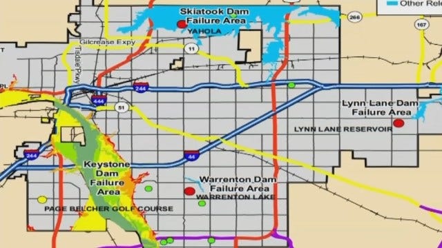
The City of Tulsa has released a new map showing areas of concern in cases of the most severe flooding.
The map is included in the city's latest Multi-Hazard Mitigation Plan which was published over the summer.
The map shows much of Brookside and areas south of there, on the east bank of the Arkansas, under water.
That's low-lying land that would flood from Lake Keystone; if the dam failed, if the levees failed or if there was so much rain it led to that much water going through the dam.
"So people need to know about the dams and levees, about the places in flood zones and the things people can do if they have property that's suffered a repetitive loss or flood event," said Tim Lovell with Tulsa Partners.
The flood map is on page 259 of the plan.

Get The Daily Update!
Be among the first to get breaking news, weather, and general news updates from News 9 delivered right to your inbox!
More Like This

December 9th, 2014

March 22nd, 2024

March 14th, 2024

February 9th, 2024
Top Headlines

April 18th, 2024

April 18th, 2024

April 18th, 2024

