LIVE UPDATES: Tornado Warning For Blaine, Caddo, Custer Counties Until 9 p.m.
Oklahoma Weather Forecast: Bookmark this page and refresh it often for the latest forecast and daily updates.Sunday, May 19th 2024, 8:40 pm


OKLAHOMA CITY -
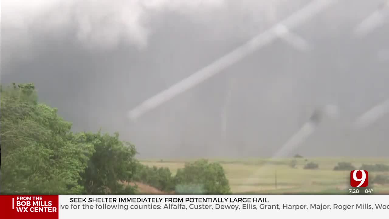
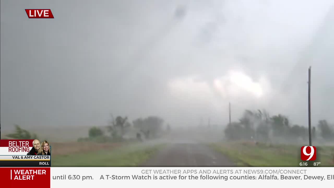
A severe storm in western Oklahoma spawned a possible, brief tornado in Roger Mills County on Sunday, and later Sunday night, a large tornado was confirmed near the town of Custer City.
The first tornado was just after 6 p.m. near Roll. As the storm advanced northwest, it brought with it large chunks of hail and damaging winds. The Custer City storm was after 7:30 p.m.
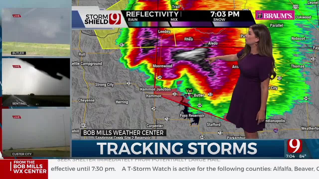
Much of northwest Oklahoma is under a Severe Thunderstorm Watch until 10 p.m., a watch that has been extended east as far as Canadian County until midnight. Storms could impact the Oklahoma City metro during the 9 p.m. hour.
News 9 Meteorologist Lacey Swope is live in the Bob Mills Weather Center tracking the severe weather.
You can watch that stream HERE, or on the KWTV/News9 Facebook and YouTube pages.

Active Watches & Warnings:
- Tornado Warning for Blaine, Caddo, Custer counties until 9 p.m.
- Severe Thunderstorm Warning for Woods, Woodward counties until 8:45 p.m.
- Tornado Warning for Custer County until 8:30 p.m.
- Tornado Warning for Blaine, Caddo and Custer counties until 8:15 p.m.
- Severe Thunderstorm Watch for Alfalfa, Beaver, Dewey, Ellis, Harper, Major, Roger Mills, Texas, Woods and Woodward County until 10 p.m.
What is the weather like for this weekend?
Hotter this weekend with summer-like highs. Remember, cars can get dangerously hot in a matter of minutes! Summer is inching closer!

Heading into the weekend, the weather will be hot and humid, and there is another chance for severe weather when an approaching weather system arrives next Tuesday.

South winds return pulling north that Gulf of Mexico moisture.

On Sunday, we'll watch a dryline closely to the west along with a low pressure to the north.

Conditions will be unstable but the CAP & lack of forcing could limit the threat.

We'll be watching it closely.

Next week is looking warm with some more chance of severe storms.
Follow our meteorologists!

Get The Daily Update!
Be among the first to get breaking news, weather, and general news updates from News 9 delivered right to your inbox!
More Like This


May 19th, 2024

May 19th, 2024

May 19th, 2024
Top Headlines


May 19th, 2024

May 19th, 2024
