Mornings Storms Bring Heavy Rain, Gusty Winds To Northeast Oklahoma
Oklahoma Weather Forecast: Bookmark this page and refresh it often for the latest forecast and daily updates.Monday, May 13th 2024, 7:06 am
TULSA, Okla. -
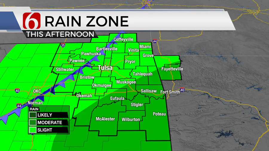
A slow-moving upper-level low nears the state Monday morning and exits the area later tonight into early Tuesday morning. A surface cold front is also expected to slide across the area later today into the afternoon.
What will the weather be like in Oklahoma on Monday, May 13?
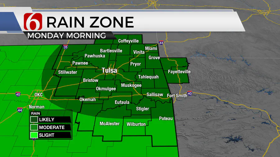
The combination of these features will bring numerous thunderstorms across the area early Monday morning. We may see a break in storms by midday with a few more scattered storms developing into the afternoon and early evening.

A few of the storms may become strong to severe, especially along both sides of I-40, including early this morning and again during the afternoon. The primary threats will be quarter hail and wind gusts near 60 mph.

There is enough shear in the atmosphere to support a mention for rotating updrafts and the non-zero chance of a brief tornado warning, mostly later Monday afternoon across the far southeastern third of the region.
Some pockets of moderate to heavy rainfall will also be possible bringing the chance for some low-land or street level high water issues for those areas that see a few training cells.

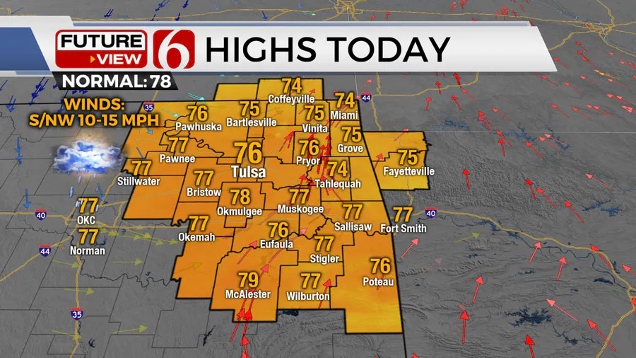
Temps will stay in the upper 50s and lower 60s this morning before reaching highs in the mid to upper 70s this afternoon.
What is the weather outlook this week in Oklahoma?
As the system exits later Monday night, most of the precip will exit most of our area, but a few lingering showers or storms will remain possible across far eastern OK and western Arkansas overnight tonight into early Tuesday morning.
We'll get a break for most of Tuesday and Wednesday before another wave nears the state with another surface boundary sagging into the area Thursday and part of Friday with additional shower and storm mentions, including the low-end possibility of a few strong to severe storms.
Highs Wednesday will stay in the lower 80s and Thursday in the upper 70s.
Data is inconsistent regarding the exact outcome of the weekend regarding shower or storm chances. We’ve elected to carry a low probability at this point for a shower or a few storms Saturday.
Temps are expected to warm into the mid-80s Saturday and the upper 80s Sunday. A much stronger upper trough nears the region early next week bringing more typical mid-May severe threats to the southern and central plains.
Outages Across Oklahoma:
Northeast Oklahoma has various power companies and electric co-operatives, many with overlapping areas of coverage. Below is a link to various outage maps.
Indian Electric Cooperative (IEC) Outage Map
Oklahoma Association of Electric Cooperatives Outage Map - (Note Several Smaller Co-ops Included)
The Alan Crone morning weather podcast link from Spotify:
https://open.spotify.com/episode/5j0ovActG8BZCOTqZQzrfU
The Alan Crone morning weather podcast link from Apple:
https://podcasts.apple.com/us/podcast/weather-out-the-door/id1499556141?i=1000646589555
Follow the News On 6 Meteorologists on Facebook!

More Like This
May 13th, 2024
May 13th, 2024


